AVALON 2019 – THE ESSENTIAL AVIATION, AEROSPACE AND DEFENCE SHOWCASE FOR AUSTRALIA AND THE ASIA PACIFIC REGION
The Asia Pacific region is undergoing major growth in defence and aviation, with budgets in many countries continuing to rise and an ever increasing level of sophistication in technologies, equipment, systems and operational methods.
One of the leading gateways to these important markets is AVALON 2019 – the Australian International Airshow and Aerospace & Defence Exposition staged at Avalon Airport, Geelong, Victoria.
AVALON 2019 will again present a unique opportunity to showcase products, technologies and services to an informed target audience and to demonstrate a marketing presence in this vibrant and vital region. High levels of economic growth and technological development have resulted in growing demand for aviation and aerospace services, products and technology, right across the spectrum from General Aviation to airlines, air forces and space.
AVALON 2019 will be a valuable opportunity for decision-makers to be informed and for exhibitors to connect with their customers.
The Australian International Airshow and Aerospace & Defence Exposition is the essential aviation, aerospace and defence event for the Asia Pacific.

WHERE TO NEXT? LOCATION, HOW WE DRIVE OUR DIGITAL FUTURE
The Locate Conference (Locate19) will explore how geospatial science is underpinning the rapid changes we are experiencing now in the fourth industrial revolution. From advanced data capture techniques, positioning, data analytics, artificial intelligence to strategy and policy, Locate 19 will explore how surveying and spatial science is a core enabling technology of the digital age . From health care, transport, consumer experience through to environment, energy, water, resources and smart cities, Locate19 will uncover the geospatial technologies driving our digital future, identify new insights and better outcomes for your organisation.
INVITATION TO ATTEND
On behalf of the Locate Conferences Australia it is our pleasure to invite you to join us at the Locate19 Conference, 8 – 10 April in Melbourne, Victoria.
Consistently named at the top of the world’s most liveable cities lists, Melbourne is Australia’s home of sport, art, live music, theatres, education and more. The MCEC Conference venue is on the banks of the Yarra River, in the heart of the city – the perfect location for the premier conference of the surveying and spatial industries in Australia and New Zealand.
With a theme of “Where to next? How geospatial science is driving our digital future” this conference will have an engaging approach that will bring together innovative global leaders who will share their ideas, knowledge, and experiences on a wide range of subjects. Every year Locate sets and shares the future direction of the industry, and brings speakers together across the government, private, non-profit and academic sectors.
You will have an opportunity to network with colleagues from all corners of the globe, have direct access to vendors and subject matter experts in the Interactive Zone, see the newest technology, and be introduced to the newest ideas in the spatial sector.
We look forward in seeing you in Melbourne.
GLENN COCKERTON & KATE WILLIAMS, CO-CONVENORS

About this Event
Everybody talks about UAV LiDAR – the engineer in planning, the forester involved in wood mass calculation, the construction companies taking part in large projects to model it before, during and after its implementation or the utility companies for their corridor mapping and infrastructures management.
Reasons enough for us to continue the Yellowscan Demo tour in Australia, under the motto « Measuring the world with UAV LiDAR ». The scope is to show this high tech tool in a real working environment and how easy it is to generate topographic data with UAV LiDAR.
During our tour you will learn about the latest solutions and use cases from YellowScan and its partners with lectures, workshops and open discussions.
We look forward to meeting you !
YellowScan will be demonstrating two systems:
– YellowScan Surveyor Ultra, the high density & long-range LiDAR solution for UAV. Thanks to its high density (600 000 shots per second), this turn-key fully autonomous system is ideally suited for high speed & long-range projects. Its light weight (1.7 kg battery included) makes it also easy to mount on any drone.
Ideal Use cases: Mining, Archeology, Powerlines.
Applanix APX-15 & Velodyne VLP-32 inside.
– YellowScan Vx-20, the high precision & long-range LiDAR solution for UAV. This system is ideally suited for long range survey needs advanced accuracy (2,5 cm) and precision (1 cm).
Ideal Use Cases: Civil engineering, Forestry
Applanix APX-20 & Riegl miniVUX inside.
LiDAR systems are renowned for under vegetation 3D modeling, and fast data processing.
Contact :
Contact us for any question at laure.fournier@yellowscan-lidar.com

SmartSat partners, participants, students and staff are invited to come together to share their research outcomes and network with industry colleagues at the SmartSat CRC Conference 2023.
The SmartSat CRC is a consortium of universities and other research organisations, partnered with industry that has been funded by the Australian Government to develop know-how and technologies in advanced telecommunications and IoT connectivity, intelligent satellite systems and Earth observation next generation data services.
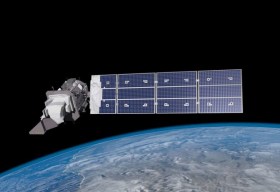
Landsat image courtesy NASA/GSFC


