The International Society for Photogrammetry and Remote Sensing (ISPRS) will hold its 2022 congress in Nice, France, in June 2022. The event will be hosted by the French Society for Photogrammetry and Remote Sensing.
A wide-ranging program has been put together, and it includes a host of leading speakers, such as Australia’s Professor Sisi Zlatanova from the University of South Wales. More than 1500 papers will be presented in the various scientific tracks and sessions over the week. In addition to these presentations, participants will also have the chance to interact and network face-to-face with the authors in poster sessions.
In order to help the registered participants to choose the sessions and the presentations to build their own program during the week, pre-recorded video presentations of the papers will made accessible before the beginning of the event through the digital platform of this event.
The Congress will have a strong technology track, with a large exhibition space that will gather the major players of the geospatial business. A geospatial prospective forum will also address hot topics of our community in order to draw recommendations.
The deadline for both full papers and abstracts is January 10, 2022.

As Australasia’s premier annual industry event, the Disaster & Emergency Management Conference attracts a passionate crowd of leaders and change-makers from government, private, and volunteer agencies working in disaster and emergency management.
Over two days, you will connect with emergency management professionals and subject matter experts offering insight, reflection, understanding and motivation across a wide range of topics and emergency management incidents.
Enjoy an impressive line-up of keynote speakers, presenters, and panel discussions, and leave with practical tools and techniques to ensure your team is best supported to better plan, prepare, and respond to emergencies, disasters, and rescue operations.
- Connect with emergency management personnel from state and local government, NGOs, and other recovery agencies.
- Explore and engage with exhibitor displays featuring the latest equipment, technologies, and agency services.
- Discover what is happening across multi-sectors via a program of renowned keynote speakers, sector representatives and lived-experience presenters.
- Gain practical tips, techniques, and strategies to incorporate into your organisation to improve the way you approach disaster and emergency planning, response & prevention.

The Ocean Optics Conference attracts a diverse audience of active practitioners in the field, including oceanographers, marine ecologists, limnologists, optical engineers, marine resource managers and policy professionals from around the world.
Conference presentations will include the science of optics across all aquatic environments, research, and applications, including (but not limited to) biogeochemistry, environmental management and applications, instruments, techniques and observational systems, remote sensing, phytoplankton ecology, radiative transfer and optical theory, global change, and benthic processes.
Attendees will attend plenary presentations during the day and interact with colleagues during scientific poster session receptions held in the exhibit/poster hall in the early evening. In addition to invited and contributed oral and poster presentations, the conference will provide the opportunity for community-wide discussions.
NASA Earth Observatory image by Joshua Stevens, using Landsat data from the U.S. Geological Survey.

Presented by the Space Industry Association of Australia, the Southern Space Symposium brings together space industry experts and decision-makers from across Australia.
This year’s Symposium will connect the space industry together with government and parliament for two days to help shape the future agenda of Australian space’s aspirations.
Participants will include federal government departments and agencies, international agencies and missions, defence and space prime contractors, listed space companies, academic and research organisations, small and medium enterprises, space start-ups and individual space professionals.

Featuring a spotlight on crowd-sourced bathymetry, the Map the Gaps Symposium 2023 will bring people together to learn, share and contribute to ocean discovery.
Held on behalf of GEBCO, this event draws global experts in ocean technology, science and policy to discuss deep and coastal ocean exploration, offshore surveying technology, policy, diversity, equity and inclusion, the Nippon Foundation-GEBCO Seabed 2030 project and GEBCO alumni activities.
Participation is open to all, including industry professionals, explorers, authors, students, researchers, government representatives and emerging technologists. Participants can attend in person or online.

Hosted by the Riverina Eastern Regional Organisation of Councils and the Riverina Spatial Information Group, Mapped Out 2023 will bring together public- and private-sector professionals to learn about the latest geospatial developments.
Mapped Out will highlight the diversity of applications for spatial data, geographic information systems and their supporting technologies. Guest speakers with local and national experience will be showcasing the use of spatial data to enhance the operation and delivery of government services.
The Conference is a great opportunity for people working in regional NSW in both local government and the private sector to keep abreast of the latest technology and geographical information systems that can be utilised in their day-to-day work.

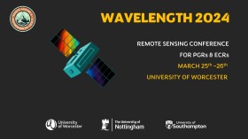
The Wavelength meeting was launched in 2013 for PhD students and early career researchers, addressing the demand for representation of new professionals as well as students from RSPSoc — the UK society for remote sensing and photogrammetry science.
Every year, Wavelength gathers participants from student and early career levels, as well as senior members and individuals within academia and business. The conference offers a setting to present student and EC work and meet new, like-minded contacts.
The 2024 conference will be run in a hybrid format, to accommodate those who can and those who cannot travel to Worcester.

The 4th International Symposium on Applied Geoinformatics (ISAG2024), which will take place at the Wroclaw University of Science and Technology, Wroclaw, Poland, on 9 and 10 May 2024. ISAG2024 is jointly organised by the Department of Geomatics Engineering, Yildiz Technical University, Istanbul, Türkiye, Wroclaw University of Science and Technology, Wroclaw, Poland and Technical University of Crete, Chania, Crete, Greece.
The aim of the 4th ISAG is to bring scientists, engineers and industry researchers together to exchange and share their experiences and research results and discuss the practical challenges encountered and the solutions adopted in geoinformatics.
Topics to be covered include recent advances in AI, satellite imagery, advanced remote sensing, photogrammetry, image processing, global navigation satellite systems, height systems, terrestrial laser scanning, GIS, smart cities and land management.


