

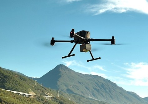
The latest addition to the ever-competitive aerial LiDAR market is the AlphaAir 6.
The LiDAR unit from China’s CHC Navigation is specifically designed for UAV-based laser scanning and LiDAR mapping, and aerial surveying in high-relief and complex terrain.
Combining prism scanning technology with a high-grade inertial navigation system, the AlphaAir 6 delivers a maximum ranging capability of up to 2,100 metres and supports efficient data capture at typical flight altitudes of 400 to 600 metres above ground level.
The device integrates a laser engine and a high-grade IMU with 0.3°/h bias stability to improve trajectory accuracy and point cloud quality, removing the need for pre-mission IMU calibration and supporting stable data collection for topographic mapping, corridor mapping and wide-area aerial survey workflows.
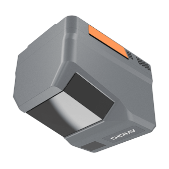
The unit’s 5th-generation real-time waveform processing with advanced multi-period technology enables the user to capture richer, denser and more precise LiDAR data across complex terrain, vegetation, and built environments. CHC Navigation says that, even at an ultra-high pulse repetition rate of 2,000,000 pulses per second, it continues to support real-time point cloud output, giving operators immediate in-flight visibility.
The 1.35kg AlphaAir 6 comes in single-camera and dual-camera configurations, each of which use large-format CMOS sensors to deliver high-resolution imagery, while the dual-camera version adds an ultra-wide field of view to improve image coverage and increase mapping efficiency.


