South Australia’s State Planning Commission is seeking feedback on the draft State-Wide Flood Hazard Code Amendment.
The draft amendment would update flood hazard mapping and planning rules across the state, based on new and updated flood studies and modelling.
The aim is to guide how developments should address flood risk and be designed to keep people and property safe from floods.
This would be achieved through:
- More consistent and updated mapping that would use the latest flood studies and data to update flood hazard overlay mapping, based on more contemporary standards and modelling, and applying the three overlays more consistently across the state;
- Improved planning rules that would introduce definitions and enhanced policies to make development assessments clearer and more consistent, and to align with national guidance; and
- Faster processes for future mapping updates, enabling a streamlined process to update the overlay mapping as more contemporary flood studies and data become available.
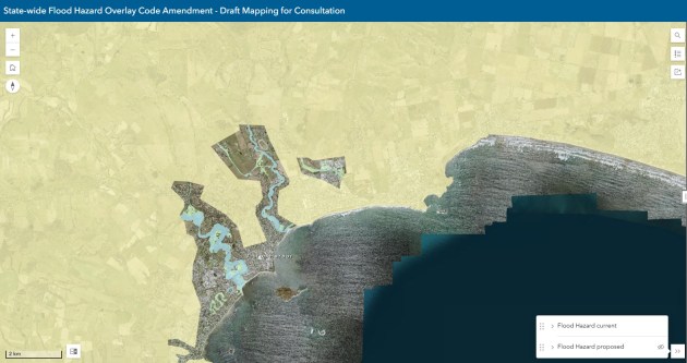
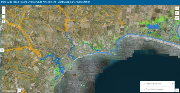
Documents, FAQs and fact sheets are available online, and before-and-after projected views of the flood modelling can be experienced via the Map Viewer.
Providing feedback via the online survey
The proposed overlay mapping and planning rules focus on flood hazards from watercourses and surface water, and have been updated with:
- 30 new and enhanced flood studies which model flood hazard out to 2050, including projected climate conditions and development growth scenarios;
- previous council flood studies which have not yet been integrated into the Planning and Design Code; and
- coarse-scale data (rather than more detailed data identified through flood studies) based on river and surface water flood information, used mostly in regional areas.
According to the State Planning Commission, these updates have enabled the Hazards (Flooding – Evidence Required) Overlay to be removed or reduced in many parts of South Australia, which should lead to lowered costs and red tape for building in areas where precautionary measures are no longer considered necessary.
In addition, proposed new and updated planning rules would provide greater protection for vulnerable people by avoiding building aged care facilities, hospitals and schools where there is an intolerable flood risk.
Interested parties are invited to provide feedback on the draft State-Wide Flood Hazard Code Amendment by Thursday, 13 August 2026.
This can be done by taking part in an online survey, emailing a submission to PlanSASubmissions@sa.gov.au, or by posting a written submission to the State Planning Commission, GPO Box 1815, Adelaide, SA 5001.
Related reading:
New flood maps rolling out in Melbourne
Mapping fast-flowing floodwaters for city safety
AI model aims to make flood-risk maps affordable