Users of the ACTmapi platform are being asked to test out new features and provide their feedback.
ACTmapi, the Australian Capital Territory Government’s online interactive mapping platform, provides a range of features of use to those in the surveying and wider geospatial field.
The platform includes the latest land information and enables users to view and query data such as that for land zoning, aerial photography, survey marks, bushfire-prone areas and more.
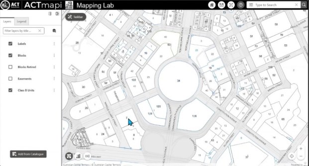
Users are being given the opportunity to try out new features and enhancements before they are finally incorporated into ACTmapi. They can do so by accessing the online Mapping Lab.
New or enhanced features under test include:
- A new search bar, into which addresses, unit plans (Class B) or deposited plans can entered;
- A cleaner, less-cluttered interface;
- More intuitive tool groupings;
- Aerial Imagery within the basemap gallery;
- An optimised basemap; and
- An enhanced zoom level (up to 1:35)
Interested users are being asked to provide feedback by 31 August by emailing spatialdata@act.gov.au.