

Banyule City is in the vanguard of new flood map modelling being rolled out across the city by Melbourne Water.
Advances in mapping are giving local governments and residents more information than ever before about the risk of flooding in particular areas.
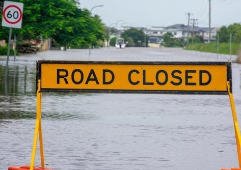
Newer flood mapping models can be a double-edged sword, with some properties ending in up what are marked as flood-prone areas, while others can have their flood risk downgraded.
In the local government area of Banyule City on Melbourne’s north-east suburbs, new flood mapping data is about to give residents the ability to search their own address and see exactly what the flood risk looks like for their property.
The new flood maps will replace decades-old data with the clearest, most property-specific flood information ever produced for the area.
Clearer planning for flood events
Melbourne Water will release the new interactive maps showing local flood hazard information in mid-June 2026.
Residents will see their property’s flood hazard based on projections for current climate conditions and future scenarios to the year 2100.
The maps will use national flood hazard classifications and are built on new, best-practice modelling that accounts for stormwater.
“These new flood maps give residents clearer information so they can plan with confidence,” said Chris Brace, Melbourne Water Executive General Manager, Service Futures.
“We’re also continuing to invest in the infrastructure to reduce flood impacts across Melbourne over time, and having accurate, up-to-date mapping is a critical part of that work.”
Melbourne Water’s plans for flood maps
The Banyule maps are part of the Greater Melbourne Flood Information Program, which will eventually cover 38 council areas. The program has already released new stormwater flood maps in Darebin, Yarra, Glen Eira and Merri-bek.
Further work is underway by Melbourne Water to update riverine flood models across Banyule into the future.
“Clear, reliable flood information helps our community plan ahead and make informed decisions about their homes and businesses,” added Cr Alison Champion, Banyule City Mayor.
“We trust the release of the new flood maps will support effective planning and stronger preparedness.”
The maps will be available from mid-June 2026 at letstalk.melbournewater.com.au/flood-information/banyule.
Melbourne Water says it plans to review its flood models every five years and update them every 10 years.


