Charles Sturt University and the Australasian Space Innovation Institute partner for agriculture digital twin.
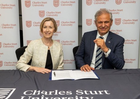
A new partnership will connect Charles Sturt University’s (CSU) bank of agriculture data and the Australasian Space Innovation Institute (ASII) to build the foundations of national digital infrastructure to support the future of Australian agriculture.
The collaboration brings together Charles Sturt’s Australian Agricultural Data Exchange (AADX) and ASII’s National Digital Twin for Agriculture Program to develop a shared digital foundation that enables agricultural data, research models, satellite observations and AI to be more effectively connected, accessed and reused.
Rather than creating a single digital twin of Australian agriculture, the program is developing the underlying infrastructure from which multiple digital twins, research tools and decision-support services can be built.
The infrastructure will provide the building blocks for researchers, agricultural technology companies, research and development corporations, industry and government to develop new applications without needing to recreate the underlying data and modelling capabilities.
Combining data, models, Earth observations and AI
AADX’s role in the agriculture digital twin project is to provide access to agricultural datasets and data services, including information about soils, water, weather and climate.
For its part, ASII will provide expertise in satellite technologies, geospatial analytics, AI and modelling.
The infrastructure is intended to support a range of practical applications, including:
- placing agricultural trial results in the context of different environments;
- undertaking virtual experiments before investing in physical trials; and
- testing how research models perform across different locations, seasons and future climate conditions.
Approximately $3 billion is invested annually in Australian agriculture research and development but less than 5% of potentially useful data is analysed to generate new information.
“Every dollar invested in Australian agricultural research and development returns $8 in the next decade,” said Charles Sturt Vice-Chancellor, Professor Renée Leon.
“This partnership will build the digital infrastructure that unlocks that return on investment and delivers tangible results for Australian producers.
“Our farmers and agribusinesses already have most of the pieces. This partnership will connect that data so that the investment keeps paying back, for landholders and for the nation as a whole.”
Broader applications
ASII Chief Executive Officer, Professor Andy Koronios, said the initiative is an important step towards building shared national digital capability.
“We are not setting out to build a single digital twin of Australian agriculture,” he said.
“Our ambition is to establish the digital infrastructure that allows researchers, industry and government to connect and reuse data, models and analytical tools to address real-world challenges.”
“By bringing together satellite observations, agricultural data, research models and artificial intelligence, we can create new opportunities to explore ‘what if’ scenarios, test ideas and better understand the potential consequences of decisions before they are made.
Professor Koronios added that while agriculture will be the initial focus, the underlying infrastructure will also have broader applications across climate, environmental monitoring and natural resource management.
Pasture management, weed control
The first high-impact agriculture digital twin application will be a $465,000-project involving Meat & Livestock Australia, Charles Sturt and ASII, involving two use cases.
The first, through Charles Sturt’s Wagga Wagga campus, will focus on cattle and pasture management, combining virtual fencing and automated livestock weight data, weather information and satellite imagery to help identify the best paddocks for cattle movement and pasture management.
The second involves managing mimosa weed in the Northern Territory, using satellite imagery and historical farm data to predict where the invasive weed is most likely to spread and where control measures can be targeted.
The project will be delivered by researchers from Charles Sturt’s Artificial Intelligence and Cyber Futures Centre and specialists from ASII.
Future use cases will investigate water availability, virtual fencing and farm-scale natural capital assessments.
Related reading:
National Digital Twin for Australian Agriculture
New space institute to tackle big challenges
Geospatial training for women in agriculture