

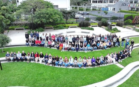
More than 100 women involved in the agrifood sector and natural resource conservation in rural Costa Rica, recently underwent training in geospatial technologies at a three-day event at the Inter-American Institute for Cooperation on Agriculture (IICA) in San Jose, Costa Rica.
The event was an advanced version of the GeoFem: Women in Geospatial Technologies workshop (also known as Rally Femenino), organised by IICA and partners such as the Central American Aerospace Network, SERVIR, NASA Harvest, Brigham Young University (BYU), the BYU Ballard Center, UNESCO, GEOGLAM and GEOGloWS.
The GeoFem workshops aim to build women’s technological, digital, geospatial and innovation capacities, enhance their growth and facilitate professional empowerment.
Participants were introduced to applications such as the GEOGloWS’ Streamflow Forecasting Service, a global hydrological model containing more than 40 years of historical flow data; and Climate Trends, which enables users to access and compare data from various global models.
They also were given training on geospatial analysis platforms such as GEOGLAM, ClimateSERV and Google Earth Engine, in order to learn how to gather satellite data and apply it to agricultural and food security monitoring.
The workshop was open to anyone 14 years of age and over. Since 2019, GeoFem has trained more than 500 women and girls in geospatial technologies.
“Forging partnerships with organisations such as the ones participating in this workshop expands the dissemination of knowledge and allows women working in the agrifood sector and in natural resource management to access these technological tools,” said Betzy Hernández, Regional Science Coordination Lead for Central America at SERVIR’s Science Coordination Office.
“The participants are gaining access to Earth observation technology applications and disaster risk management tools. In this workshop, participants gain exposure to knowledge from highly trained professionals,” added Luis Ramos, USAID Project Management Specialist.


