

Our weekly round-up of all the geospatial news that didn’t make it into our normal daily coverage.
If you have a Spatial Snippet to share with our readers, please send us an email.
Here are a few geospatial jobs we’ve spotted over the past week.
First up are two positions with application deadlines of today. The Victorian Department of Energy, Environment and Climate Action has two Landscape Evaluator positions going, one based in the Port Phillip Region and the other in the Loddon Mallee region. Both jobs require demonstrated experience in field-based ecological monitoring and program evaluation, and proficiency in GIS and spatial data analysis, with a strong focus on translating insights into operational decision-making.
The similarly named NSW Department of Climate Change, Energy, the Environment and Water has an opening for an Assistant Project Officer to work in its Reserve Access Program. Amongst the role’s functions is the use of spatial information systems to assess legal and practical access to NPWS-managed land. Applications close 14 May.
And in Queensland, the Department of Transport and Main Roads is seeking a Surveyor (Construction) to join its Toowoomba team in a permanent role as part of RoadTek, a commercial business within the Department that provides transport infrastructure solutions for projects across Queensland. Applications close 26 May.
If you’re interested in GNSS-based navigation and/or are concerned about jamming and spoofing, then an Australian Institute of Navigation webinar on 25 May is for you. Captain Matt Shirley, CEO and co-founder of Safe Harbours Australia, will outline the maritime industry’s growing reliance on GNSS-enabled technologies, and what this reliance means for safety and security. And it’s not just threats to the GNSS that are the problem — waterways are becoming busier and more constrained, and automated navigation is bringing its own risks.
If satellite-based synthetic aperture radar is more your thing, there’s an online seminar coming up on 15 May organised by Earth Observation Australia. Special guest Dr Paul A. Rosen, Project Scientist at NASA’s Jet Propulsion Laboratory, will provide an overview of the primary science objectives of the NISAR satellite. The mission is a joint effort between the US and India, with objectives that include measuring surface deformations with sub-centimetre precision, biomass estimation and carbon cycle monitoring.
The start of 1Spatial’s World Tour 2026 is less than two weeks away, and the agenda and list of speakers has now been released. The Tour is taking in every Australian capital city plus Singapore between 18 May and 4 June. One of the major foci of discussion will be the latest improvements in FME 2026.1, but no doubt the recent acquisition of 1Spatial by VertiGIS will also be a hot topic.
Here are some other upcoming regional events and activities to take note of:
- Practical spatial editing in Metrix Assets, 13 May
- Leica Future Forum, 14-15 May
- Tasmanian State of GIS Conference 2026, 3 June
- Webinar: What’s Next for Pozi, 4 June
- 2026 National Surveying Congress, 3-6 August
- Spatial Information Day 2026, 7 August
- GeoCart’2026: 12th National Cartographic Conference, 26-28 August
- Survey and Spatial New Zealand Conference 2026, 9-11 September
- 2026 Advancing Earth Observation Forum, 9-12 November
- LOCATE26/10th Digital Earth Summit, 24-26 November
- 2026 Pacific Islands GIS & Remote Sensing User Conference, 30 November
Today (6 May at 23:59 UTC) is the deadline for abstract proposals for the Third United Nations World Geospatial Information Congress, the quadrennial flagship event of the Committee of Experts. The organisers are inviting contributions to the Congress’s discourse and high-impact, forward-looking program.
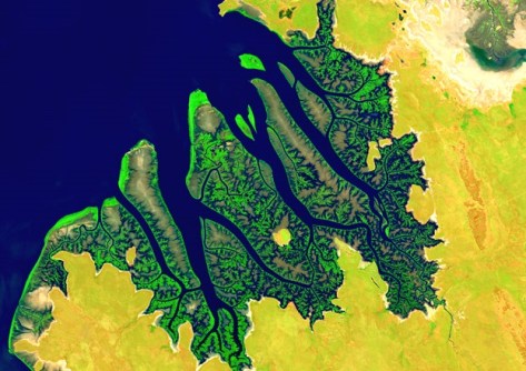
Digital Earth Australia (DEA) has announced the latest annual product updates for the following:
- DEA Coastlines (2025 annual data)
- DEA Intertidal (2024 annual data)
- DEA Tidal Composites (2024 annual data)
According to DEA, the updates provide a “nationally consistent view of Australia’s coastlines and align coastal datasets with DEA’s annual terrestrial data cycle, helping users confidently monitor and compare change across land, water and coastal zones”.
Finally, Land Use Victoria (LUV) has advised that email addresses ending in @delwp.vic.gov.au are no longer active, and the former LUV Legal email address (lv.legal@transport.vic.gov.au) is no longer in use. To get in touch with LUV, head to its contact page.
Make sure you don’t miss out any geospatial news from across Australia and around the world — subscribe to our free Spatial Source newsletter, sent out every Wednesday and Friday morning.


