

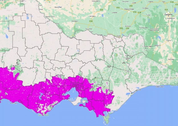
Initial DCM adjustments have been completed across approximately 50% of Victoria’s land parcels. Courtesy Vicmap.
Victoria’s Department of Environment, Land, Water and Planning (DELWP) has announced that major progress is being made on its Digital Cadastre Modernisation (DCM) project, with the publication date for changes to Vicmap getting closer.
Data from the DCM project will be integrated with Vicmap to provide customers with an enhanced user experience of the property and parcel data layer.
As of June 2022, delivery partner Spatial Vision had completed initial adjustment across approximately 50% of Victoria’s land parcels.
It is intended that publication of the upgraded Vicmap will be rolled out by local government area from October 2022 through to December 2023, with consultation ongoing with stakeholders to refine the publishing schedule.
The indicative order and timings of the data release and publication is available on the adjusted data release web page.
Interested parties can see how the spatial upgrade to Vicmap will affect their organisation, by viewing and analysing the spatial uplift that will apply to their geographical area of interest before the data is published into Vicmap.
Information sessions about the data release and access to key readiness tools, can be arranged by contacting the DCM team via digital.cadastre@delwp.vic.gov.au.
Stay up to date by getting stories like this delivered to your inbox.
Sign up to receive our free weekly Spatial Source newsletter.


