

Two new satellite constellations will combine high-resolution with frequent revisit schedules.
Satellite imaging company Vantor (formerly known as Maxar) has announced plans to launch two new constellations of high-resolution imaging satellites.
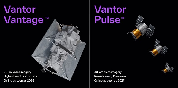
The Vantor Vantage fleet will comprise a new generation of 20cm-class imaging satellites which, the company claims, will deliver the highest commercial resolution on orbit.
And Vantor Pulse will be a fleet of 40cm-class satellites designed for persistent, high-frequency monitoring.
The company says the result will be the “first commercial space-based system combining accurate, high-resolution imaging with real-time global monitoring”.
Five-fold boost
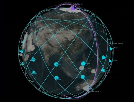
Vantor says the system will resolve the traditional trade-off between resolution and revisit frequency. It used to be that you could have one or the other, but not both.
The company says its current WorldView Legion constellation can collect over 3.5 million square kilometres of 30cm-class imagery each day and revisit the same location on Earth up to 15 times per day.
It says the new system will boost revisit rates five-fold, providing imaging of the same location on Earth as often as every 15 minutes.
Such a capability would enable customers to detect changes, maintain up-to-date maps, track activity, and predict emerging threats at high speed.
Real-time capability
Vantor aims to bring the first Pulse satellites online as soon as 2027, followed by the first two Vantage satellites as early as 2029.
“Vantage and Pulse usher in a new era of space-based intelligence — it’s the first time that governments and businesses can get both detailed imaging and real-time monitoring from a single commercial system,” said Dan Smoot, Vantor CEO.
“That fundamentally changes how intelligence is generated and used. Instead of choosing between accuracy and speed, customers can seamlessly collect, fuse, and deploy our multi-class intelligence within their sovereign systems, turning space-based data into a real-time operational capability.”


