


With the launch of the first two of 11 satellites, the Celeste system is on its way to supplementing Galileo.
A Rocket Lab launch vehicle has propelled into orbit the first two satellites of a planned 11-spacecraft constellation for Europe’s Celeste technology testbed.
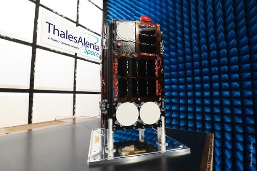
In essence, the Celeste satellites are small versions of GPS or Galileo navigation satellites, designed to operate in a low Earth orbit (LEO), or layer, unlike the much higher orbits in which traditional GNSS spacecraft operate.
One of the benefits of this lower altitude will be higher received signal strength, useful for combating jamming.
Celeste and other similar systems are intended to complement or supplement the traditional GNSS constellations.
On-orbit test bench
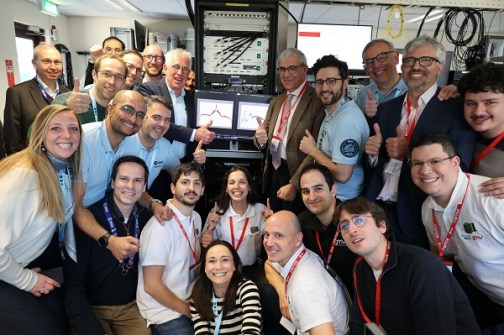
The initial two Celeste satellites have been built by different industrial consortia, one led by Spain’s GMV and other led by France’s Thales Alenia Space.
One of the main aims of the project is to validate core technologies, new signals and service capabilities, and employ frequencies in the L and S bands.
The mission will act as an on-orbit test bench for a range of applications, such as:
- Enhanced navigation capabilities for autonomous vehicles, railway, maritime, and aviation;
- Increased availability in urban canyons and remote polar and arctic regions;
- Enhanced positioning and messaging for emergency services during disasters;
- Tracking of connected devices and Internet-of-Things applications, and
- Indoor navigation.
No longer optional
LEO positioning, navigation and timing (PNT) is seen as a new, promising frontier for reducing reliance on the long-established GNSS. As systems and sectors have become more dependent on the GNSS, so have they become more vulnerable to disruptions, whether that be from technical problems or malicious actors.
As reported by Spatial Source last month, a new report (‘LEO PNT State of the Market’) from FrontierSI reveals that the number of identified LEO PNT initiatives rose from nine to 14 in just one year.
“Reliable positioning and timing services underpin everything we do, from telecommunications to financial systems,” said Graeme Kernich, CEO of FrontierSI.
“This means building system resilience is no longer optional, and LEO PNT infrastructure plays an important part in offering alternatives.”
See also:
Skykraft announces India partnership for LEO PNT


