

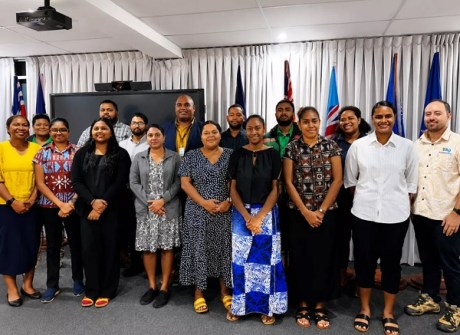
Experts from across Fijian government agencies have undertaken training to strengthen their capabilities in using satellite data to monitor landscape changes.
The training was provided by the Pacific Community (SPC) through its Digital Earth Pacific (DE Pacific) program and took the form of a three-day technical workshop.
Thirteen participants — 64% of whom were women — attended from five different government departments:
- Ministry of Forestry
- Ministry of Fisheries
- Ministry of Lands and Mineral Resources
- Ministry of Agriculture, Waterways, and Sugar Industry
- Ministry of Environment and Climate Change,
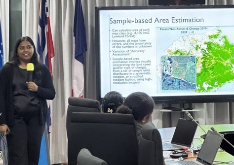
Participants learnt how to use satellite data and imagery, digital mapping tools and field surveys to monitor changes in land use and ecosystems.
“By bringing multiple ministries together through this workshop, countries are strengthening the shared technical capacity needed to build nationally led land cover monitoring systems,” said Mr Maivunijale Waqa, Earth Observation Technical Assistant at SPC.
“This collaborative approach supports more reliable environmental monitoring and stronger evidence-based decision-making for climate resilience and sustainable development.”
Strengthening Fiji’s land monitoring capability
Fiji is facing issues with development, extreme weather and climate change, with its forests, coastlines, agricultural areas and urban spaces coming under pressure.
Understanding how those areas are changing over time is becoming increasingly critical for maintaining communities, ecosystems and national planning.
The key is reliable environmental data and land cover information, which are vital for tracking changes in forests, mangroves, agricultural areas and other ecosystems, while also supporting greenhouse gas inventories, climate reporting obligations and long-term land management planning.
That’s why the workshop focused on strengthening national capability in land cover mapping, modelling and monitoring using satellite Earth observation technologies, geospatial analysis and field-based data collection.
“Through this training, Fiji is advancing a more coordinated and nationally owned approach to land cover monitoring,” said Ms Zoyha Nisha, GIS and Remote Sensing Officer with Fiji’s Ministry of Forestry.
“Strengthening local capacity to map and monitor the six IPCC land use classes will support more credible reporting under the Climate Change Act and other international commitments, while helping ensure Fiji has reliable environmental data to support future planning and decision-making.”
National land cover data and classifications
The workshop supported the work of Fiji’s cabinet-endorsed National Landcover Monitoring Working Group (NLWMG), which was established in 2023 after the Fiji Geographic Information Management Council identified the need for a common, nationally authorised land cover classification and dataset.
DE Pacific is SPC’s regional Earth observation program, supporting Pacific Island countries and territories in using satellite data and imagery and geospatial technologies for climate resilience, environmental monitoring and evidence-based planning.


