

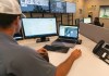
The platform will streamline the machinery company’s facilities and operations management.
Search results for "asset management"

Interview: Robert Rowell, Insight GIS
In our annual Leaders Forum, we ask experts to look ahead into 2023. Today we talk GIS with Robert Rowell.

Vicmap spatial upgrade is now underway
The aim is to provide an enhanced and more accurate digital representation of Victoria’s cadastre.

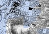
Cross River Rail’s digital twin revolution
CRR’s 3D digital modelling is continuing to produce transformative new practical applications.

Q&A: Narelle Underwood, DCS Spatial Services
A love for the built environment has resulted in the building of an impressive career in surveying.
Annual Breakfast Seminar 2022
When:
10 October, 2022 @ 7:00 am – 18 October, 2022 @ 10:00 am
Registrations for 1Spatial’s Annual Breakfast Seminar 2022 are open! We would love to invite you to join our 3rd Annual Breakfast Seminar 2022 this October, which has limited number of seats available. We are delighted to say[…]

Spatial Vision expands strategic advisory team
Georgina Race and Kimberley Worthy take up senior consulting positions within Spatial Vision’s advisory team.

Why ‘set and forget’ is not an option
Why ‘set and forget’ is not an option — understanding technical debt and how it undermines business value.
Business intelligence with location data
Location intelligence has come a long way. Technological advancements will take it even further.
Nearmap mulls $1 billion takeover offer
Nearmap has received a non-binding indication of interest from Thoma Bravo, a US software investment firm.