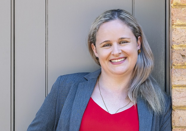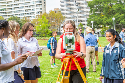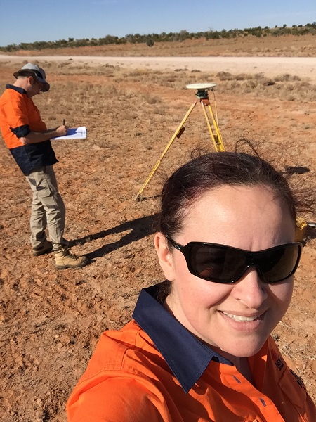
Narelle Underwood is Surveyor-General of NSW and Executive Director of NSW DCS Spatial Services.
A love for the built environment has resulted in the building of an impressive career in surveying.
Narelle Underwood joined Roads and Maritime Services (RMS, now Transport for NSW) in 2009 as part of its graduate program, completing her registration exams and becoming a Registered Land Surveyor in 2010.
During her time with RMS, she worked on a range of road infrastructure projects and held several senior roles, including Southern Region Survey Manager and Principal Surveyor. In October 2016 she left RMS to become Surveyor-General of NSW, and in May 2022 she was appointed Executive Director of NSW DCS Spatial Services.
********************
What was your pathway into this industry?
From an early age I decided that I wanted to work in the built environment. Originally I thought about architecture, but in high school I decided on civil engineering. In my second year of university, I got a job with a private surveying firm as a draughtsman and fell in love with the industry, so I decided to change degrees with the intent of becoming a registered land surveyor. I worked throughout my undergraduate degree, gaining a lot of experience in town planning and engineering design, and graduated from UNSW in 2009 with a Bachelor of Engineering in Surveying & Spatial Information Systems.
As Executive Director of NSW DCS Spatial Services, are you still Surveyor-General?
As part of the recruitment process I successfully negotiated retaining the Surveyor-General title, so my official title is now Surveyor-General & Executive Director Spatial Services.
Please tell us about your Spatial Services role.
Spatial Services has two main office locations in Bathurst and Sydney and several regional offices in Nowra, Newcastle, Coffs Harbour and Lismore. With our flexible work arrangements, I split my time between working from home and our Sydney and Bathurst offices.
In addition to leading the Spatial Services team, I am part of the Digital.NSW leadership team; I represent NSW on ANZLIC; I am the NSW shareholder proxy for Geoscape Australia; and I represent Spatial Services, Digital.NSW and Department of Customer Service on a variety of project, strategy and industry committees — this includes the State Emergency Management Committee and the eConstruction Steering Committee.
What is Spatial Services’ remit?
Spatial Services is a division of the Department of Customer Service and provides NSW’s spatial and land information services. Our data products provide the foundation for NSW’s mapping and spatial information systems and are used for building better services across the community, government, industry and the environmental sectors. Our functions include:
- Foundation spatial data products and services (Six Maps, Spatial Collaboration Portal, topographic maps, aerial imagery and LiDAR)
- The Emergency Information Coordination Unit
- Survey operations (CORSnet-NSW, Survey Control Information Management System, State control survey, surveying legislation)
- Board of Surveying and Spatial Information
- Geographical Names Board
- Digital Services (printing and graphic design)
We’re undertaking a range of projects based on the Foundation Spatial Data Framework (FSDF) to streamline government processes in terms of planning, design and modelling for NSW’s future needs. Key projects include:
- Live NSW: This incorporates the Spatial Digital Twin (a cross-sector, collaborative environment which will share and visualise a 4D model) and the Gravity Model (critical geoscience information for infrastructure projects and the management of natural hazards and resources).
- Cadastre NSW: A service for local government authorities to capture and visualise the progress of subdivision developments and increase efficiencies for planning and land development while providing access to intelligent digital property data.
- Digital Survey Plans: Transitioning from ‘paper’ to intelligent digital survey plans to support a more efficient, accurate and accessible land title system.
- Survey Plan Digitisation Project: Digitisation of hard copy survey and strata plans into LandXML and GeoPackage formats.
- Historical Aerial Photography Enhancement Project: Using the state’s 70-year repository of aerial photography to create a 3D digital database to understand how the landscape has altered and to preserve the archival records.
- Whole-of-Government Addressing: The roll out and use of the authoritative NSW Address Database for address verification throughout NSW Government agencies via NSW Point.
You wear a lot of other hats, too, don’t you?
The Surveyor-General is president of the Board of Surveying and Spatial Information (BOSSI), which is the statutory body responsible for the registration of land and mining surveyors in NSW. My key focus areas have included: Improving engagement with the profession, industry bodies and allied professions; raising the profile of BOSSI and surveying across government; improving the complaints and disciplinary process; prosecution of unregistered surveyors undertaking land surveys; and supporting candidate surveyors through the registration process.
The Surveyor-General is also the chair of the Geographical Names Board, which is the official body responsible for place naming in NSW. A key focus area for me has been Aboriginal place naming, which encompasses both the use of Aboriginal language in naming and the recognition of traditional Aboriginal place names for geographical features.
I have been involved with the NSW Surveying Taskforce in a few different capacities since it was established 10 years ago. Its prime focus is to raise the profile of the profession, highlighting career opportunities and encouraging more people to join the industry.
What makes you so passionate about this industry?
There are so many reasons. For starters, I cannot think of any other industry that gives you such a wide variety of career options. I recently filmed a masterclass with CSIRO as part of their Generation STEM program and we touched on at least 10 very different specialisations, which is great as we know that the younger generations are not looking for traditional single-job careers and our industry provides an opportunity for a portfolio career without actually changing industries.
I also love that no two days are the same. Each project, policy or strategy means that I am using different skills and learning new things all the time. To be honest, I feel like surveying and geospatial is as much a hobby as it is a job.
For me it has always been about community and place. As I mentioned earlier, I have been fascinated by the built environment since I was young (Lego and SimCity were some of my favourite hobbies growing up). I have enjoyed influencing the design of the communities that people live in, and while my role in that process has changed, I now get to support decisions that are being made about the built and natural environment through the utilisation of geospatial information.

What do you see as the challenges facing the industry?
Skills shortages in areas of surveying, geospatial and digital, and building capacity and capability in our existing workforce to meet the changing expectations of our customers. And as a result of the combination of increased demand and the skills shortage, I have seen mentoring and training support reduced. If we do not continue to develop and evolve our skills, other industries will step in and start delivering.
Then there’s identity. I would suggest that the majority of people utilising geospatial information don’t identify themselves as being ‘geospatial’ professionals. They likely see geospatial as part of their toolkit, not their profession.
And diversity. There is a lack of diversity in the industry in regard to age, experience, skills, gender and education.
And the opportunities?
Opportunities include engaging with a broader audience and allied professions to raise the profile and understanding of our industry, and opening up new markets and opportunities. Everything happens somewhere, so the potential for impact is significant… as many people have only just started to realise the real power of using geospatial data to support evidence-based decision making.
And we’re seeing significant investments from governments in data as an asset, as well as opportunities to contribute to the transformation of data systems and processes — further recognition of the value this industry can contribute to the economy.
What are the industry’s strengths?
Innovation, resilience and adaptability. While some areas of the industry have been slow or resistant to change, generally speaking it has embraced technology changes and innovated to provide improved services for our customers.
Project, data and land management. While the democratisation of measurement means that any person can use a device to capture and create a geospatial dataset, increasingly projects are reaching a level of complexity such that good data management is a key for success.
Another strength is understanding metadata… knowing when data is fit for purpose and how to combine data from different sources, taking into account accuracy, currency and projection.
What’s on your wish list?
Better collaboration. Despite recent growth we are still a small industry with a fractured voice. There are too many organisations representing surveying and geospatial, competing for membership and attendance at conferences and at continuing professional development events.
You can connect with Narelle Underwood via linkedin.com/in/narelleunderwood/ and follow DCS Spatial Services at linkedin.com/company/spatial-services-nsw/.
This article was first published in the Oct/Nov 2022 issue of Position magazine.
Stay up to date by getting stories like this delivered to your inbox.
Sign up to receive our free weekly Spatial Source newsletter.


