The 9th International Colloquium on Scientific and Fundamental Aspects of GNSS will bring together members of the European scientific community and their international partners involved in the use of Galileo and other GNSS in their[…]
Search results for "UAV"

9th International Colloquium on Scientific and Fundamental Aspects of GNSS

Drones adoption continues to soar: 60 million commercial flights by 2043, saving Australian businesses over $10 billion.
A comprehensive report from Airservices Australia has unveiled insights into the future of drone operations across Australia, predicting an escalation in commercial drone flights to more than 60 million commercial flights by 2043. In addition, a recent Australian Federal Government study estimates the expanding drone use is forecast to give a major economic boost for Australian businesses, with […]

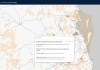
Government releases new Local Drone Rules map
UAV users can now easily see whether they need to obtain authorisation to fly in certain areas.

Carbonix flight milestone for SA Power Networks
The Australian-made Volanti UAV conducted a BVLOS inspection of 150 km of powerlines.

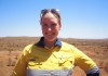
IWD 2024: Interview with Grace Mulcahy
We’re celebrating women in the geospatial sector. Here we speak with mine surveyor, Grace Mulcahy.

Here’s what’s in our latest issue!
Learn about the metaverse, mapmaking, 3D scanning, RINEX, hyperspectral EO and more in the new issue of Position.

Advanced Navigation awarded $1m for LiDAV research
The funding will be used to develop LiDAV navigation sensor technology for Earth applications.

Here’s what’s in our latest issue!
The Dec/Jan 2023-24 issue of Position magazine is out now, packed full of all the latest geospatial news.

Report: S+SNZ’s 2023 annual conference
Survey and Spatial New Zealand’s annual meeting was a celebration of surveying and spatial excellence.

Point cloud creation and processing in Global Mapper Pro v25
Pixels to Points within Global Mapper Pro creates photo-textured 3D models, orthoimages and high-resolution point clouds.