

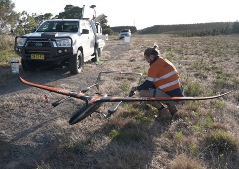
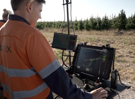
In what has been claimed an Australian first, Australian drone manufacturer Carbonix has flown a Volanti drone on a beyond visual line of sight (BVLOS) mission to inspect 150 kilometres of SA Power Networks powerlines in remote South Australia.
The CASA-approved mission opens the door to more-efficient and safer inspections of South Australia’s vast electricity distribution network, which covers more than 180,000 square kilometres.
Carbonix and SA Power Networks have been working together to pursue the use of long-range UAVs for the past 18 months.
“This is such an exciting time for the drone industry and for the energy industry,” said Carbonix CEO Philip van der Burg.
“We’ve addressed the risks and barriers, both regulatory and technical, and proven the capability. Long range drone adoption means improved safety, faster response times and reduced carbon footprint for companies like SA Power Networks.”
Inspections are currently conducted using conventional crewed helicopters and fixed-wing light aircraft, or ground crews. A switch to drones would bring large reductions in operating costs and CO2 output, while also boosting safety and efficiency.
“We rely on aerial inspections to be able to meet inspection cycles,” said Head of Corporate Affairs for SA Power Networks Paul Roberts.
“Our crews also drive about 20 million kilometres annually patrolling and maintaining our vast network.
“Being able to deploy over the horizon drone patrols will drive greater efficiency in our asset management program and provide genuine safety benefits for our people and community.”


