


By Andrew Blackman
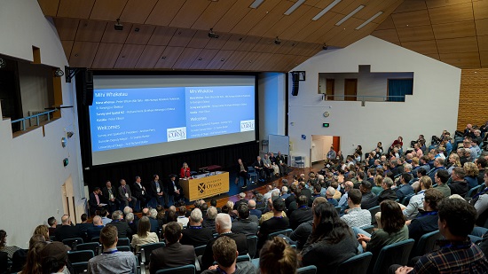
Having the annual Survey and Spatial New Zealand (S+SNZ) conference at the University of Otago in Dunedin was always going to result in a good attendance, and this proved to be true with the 135th conference.
Held in early September, the conference, along with the 60th anniversary celebrations of the University of Otago School of Surveying, was a strong drawcard for members, especially those who had attended the survey school as students.
More than 350 delegates enjoyed taking part in the three-day event, which offered more than 70 presentations covering a diverse range of topics, including technical papers on infrastructure, hydrography, surveying, technology, protecting heritage buildings, GIS, GNSS, LiDAR, UAVs and point clouds. There also were presentations covering emergency management, subdivision governance, diversity, statutory matters and Landonline reforms.
Following the Mihi Whakatau, the traditional Māori welcome, the conference was opened by various dignitaries including the Minister for Toitū Te Whenua, Land Information New Zealand the Hon. Damien O’Connor. Key plenary sessions included an update on NZ activities by Toitū Te Whenua’s Surveyor-General, Anselm Haanen.
The theme of ‘Marking the Journey, Hāpaia’ encapsulated the career trajectories of surveying and spatial professionals: the journey of seeing a project through to completion, the journey of data from capture to deliverables, and the professional development journey… and of course, coming full circle back to the university, the 60-year journey of the School of Surveying.
A powerful presentation within this theme was given by Luke Keats of Aurecon, who described New Zealand’s biggest infrastructure project following the Kaikoura earthquake in 2016. The magnitude 7.8 event struck the northeast coast of the South Island and resulted in landslides, tsunamis and areas of huge ground uplift across the complex fault rupture. The destruction severed key transport links including the Main North Railway Line and the State Highway 1 coastal road, which connected Kaikoura with Picton at the top of the South Island. These major pieces of infrastructure support the movement of freight, tourists and information around the country, all essential to keep New Zealand working.
The presentation described the incredible journey of those involved in the reconstruction project, which was carried out over the course of 3.5 years, and the sharing of valuable lessons learnt. The work involved providing engineering and geospatial services to support the recovery effort — from the re-establishment of geodetic control, extensive topographical survey and laser scan capture through rail tunnels to support assessment efforts; to the design and visualisation of proposed roading and rockfall protection solutions; and the as-builting of completed works.
Another thought-provoking presentation, by Wally Sandford of LandPro, raised the issue of protecting historical survey features such as trig beacons from developing technologies, changing priorities and cultural considerations — a topic that is close to the hearts of many surveyors.
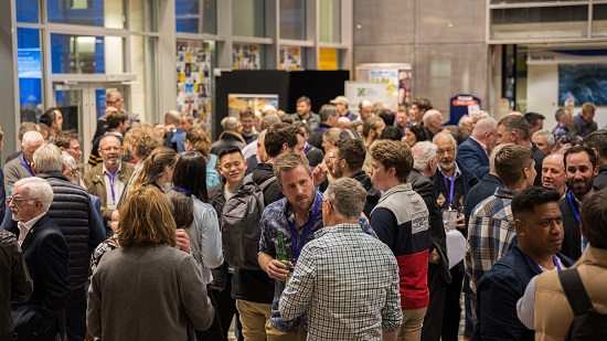
The Awards Dinner — generously sponsored by long-term partner, GSI Insurance Partners, led by Glenn Stone — is always a highlight of each conference. A black-tie event, it provides the ideal vehicle for honouring the impressive achievements of S+SNZ members throughout the year. Both individual and team project excellence was celebrated with the presentation of the Bogle Young Professional of the Year, the Cadastral Survey Award, Professional Project Excellence Award, Professional Stream Awards and the Consulting Surveyors of NZ Leadership Award. Neale Faulkner, long-term S+SNZ member and Chair of the NZ Cadastral Survey Licensing Board, was the well-deserved recipient of the McRae Supreme Award. We also welcomed two new Fellows: Dr Kat Salm and Jayne Perrin.

It was fitting that a book detailing the history of one of New Zealand’s most prolific and well-respected surveyors, Archie Bogle was featured at the conference and made available for purchase. Publication of The Measure of the Man was supported by the Kairūri Community Trust, and it is proving to be very popular amongst S+SNZ members.
The School of Surveying celebrated its 60th birthday by holding several events before, during and after the conference. This included a well-attended Anniversary Dinner attended by past and present staff and students, along with entertaining speeches from various deans of the school.
A series of workshops were offered by the School, giving people the opportunity to attend sessions on 12d software updates, Landonline capture and cadastral boundary definition, hydrographic developments and the new S+SNZ certification framework, and ending with a Q&A session on cadastral licensing.
A tour of the School’s premises proved popular with past students and recent graduates, giving them a chance to see what had changed. However, for many of the more senior S+SNZ members, who were more familiar with the previous location, it was a chance to see the School’s current home for the first time.
The finale of the School’s celebration came when current staff members, Richard Hemi and Emily Tidey, presented a light-hearted journey back through 60 years of fun and learning, including many old photos and some costumes.
S+SNZ is very grateful to all its sponsors and supporters — their continued support is critical to the success of the conference. This year we thank our Premier Commercial partners GSI Insurance Partners, 84 Recruitment, Global Survey and Allterra; and the Conference Sponsors Landpro, 12d Model, Quickmap, PIX4D, Position Partners, Buildmax, Ferntech, Synergy Positioning, Toitū Te Whenua, Land Information New Zealand, GNS Science Te Pū Ao and Abtrac, as well as the University of Otago.
Feedback on the conference has been extremely positive and congratulations goes to all involved. We are now looking forward to next year’s event, to be held in Napier in the Hawkes Bay wine country. Further information on that event will be posted at www.surveyspatialnzconference.org.
Andrew Blackman is a NZ Licensed Cadastral Surveyor practising in Auckland and an S+SNZ Independent Councillor.


