Lisa Bush’s geospatial career has seen her shift from military mapping and intelligence to leading the development of vital civilian systems.
As National Location Information Branch Head at Geoscience Australia, Lisa Bush is playing a key role in the delivery of vital national geospatial capabilities and innovative projects such as the Digital Atlas of Australia. She came to the role having had a long and distinguished career as a geospatial expert and leader within the Australian Defence Force, with deployments both overseas and at home.
At the time of writing, Bush had recently returned from New York, where she had led the Australian delegation to the 13th Session of the United Nations Committee of Experts on Global Geospatial Information Management (UN-GGIM).
What were some of the outcomes of the recent UN-GGIM Session, and what was Australia’s involvement?
For me it was a week of extreme contrasts. During my deployment some years ago with the United Nations Mission in South Sudan, I was focused on tactical delivery for UN geospatial initiatives. Fast forward a few years to leading the Australian delegation at UN-GGIM, and I had the privilege to be part of the strategic decision making at the UN-GGIM at the UN headquarters in New York. It was such an eye-opening and humbling experience.
Some key developments included updates on the UN-GGIM Centres of Excellence — in particular, the establishment of the Global Geodetic Centre of Excellence in Germany, with Geoscience Australia’s own Nick Brown moving to Bonn, Germany, to take on the role as Head of Office. The endorsement for the establishment of a new UN-GGIM Geospatial Centre of Excellence in Saudi Arabia was also an exciting update. Geoscience Australia is looking forward to working closely with these initiatives in years to come.
Australia presented a significant body of work on the Global Geodetic Reference Frame that is important not only for Australia but also on a global scale. This is especially crucial given our increased reliance on position, navigation and timing services to underpin so many activities, many of which are critical to a healthy GDP.
There was a lot of work on the development of geospatial standards and some interesting discussions about authoritative data versus ‘fit-for-purpose’ data. These evolved into the recognition that what we often care most about is actually understanding and articulating the level of trust in geospatial data — something we are actively exploring at Geoscience Australia as part of our delivery of the Digital Atlas of Australia.

The discussions at UN-GGIM also delved into the realm of geospatial ecosystems and how to better connect them given the rapid growth in technology in recent years such as Integrated Geospatial Infrastructure. The Australian delegation provided insights into a number of Australian initiatives including the wins and lessons learned from the Digital Atlas of Australia, as well as the impressive spatial digital twin journeys that quite a few of our states and territories are on right now.
How would you rate Australia’s public sector geospatial ecosystem maturity compared to that of other countries?
As a geospatial professional, I see the gaps and the massive opportunities. When I look at what is happening in this space around the world, Australia’s public sector geospatial scene is in many areas holding its own. We’ve made impressive strides with initiatives like the Digital Atlas of Australia and Digital Earth Australia from Geoscience Australia, and the successful digital twin initiatives from the states and territories.
While some countries might be further along, our commitment to innovation and collaboration keeps us competitive. It’s a journey, and we continue to be well regarded in the international geospatial landscape.
Your team is leading the delivery of the Digital Atlas of Australia. Can you briefly outline what it is and what its aims are?
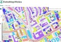
The Digital Atlas of Australia is an Australian Government initiative that’s bringing together, curating and connecting trusted location data from across government. Powered by an Integrated Geospatial Infrastructure, it enables data to connect across borders, jurisdictions and patterns, to improve access and use of location data, boosting insights for smarter decision-making. Whether it’s for government, businesses or the public, the aim is to make location data work better for everyone.
We’re in the beta phase, so there is a long and exciting road ahead for the Digital Atlas. Our plan is to continue to work hand in hand with partners across government to beef up functionality and expand the data available. Looking ahead, what we would really like to do at Geoscience Australia is identify and fill the gaps in our national foundation data to truly realise the potential of location-enabled decision-making for all Australians.
What are some of the challenges you faced in developing the Atlas?
Developing the Digital Atlas came with its fair share of challenges, and among these, three significant hurdles come to mind. Foremost, finding the right technology that can seamlessly handle interoperability and scalability to ensure the platform can grow and adapt with changing needs is essential.
Wrangling and harmonising the diverse range of data from a range of sources and critically assessing if they are fit for purpose is a big one. What is currently available in the Digital Atlas is the best available, but we know it could be better. It could have more current and accurate data, and so we are focused on working with data producers and suppliers to get the right data, at the right quality and currency needed to support meaningful outcomes and, ultimately, leave no gaps in our foundation data.
Another major challenge lay in accommodating the needs of a diverse user base. Our aim was to create an accessible platform that caters to users with varying levels of geospatial experience. Striking a balance between providing information in a straightforward format for novices while also offering detailed metadata for geospatial experts was no small feat. It’s an intricate dance of simplicity and comprehensiveness that we will continue to choreograph.
How much needs to be done to ensure Australian government geospatial systems and services remain up to the task?
Definitely, there’s some work to do in keeping our geospatial game strong. Tech keeps evolving, and with more data and new demands, it’s sometimes hard to see what’s coming. Connecting various departments, upgrading tech and keeping up with user needs is pushing us to innovate and stay sharp in this ever-changing landscape. However, we are on the right path.
The recent beta release of the Digital Atlas is a game-changer in how we harness geospatial data for smarter decision-making. Designed as a scalable and future-proof platform, the Digital Atlas holds enormous potential, particularly with future possibilities of AI and ML integration — when we are ready!
But, beyond the tech and data, we’re facing some other challenges. Finding and keeping skilled geospatial professionals isn’t a walk in the park. Thankfully, government and industry partners are actively collaborating to bolster our existing workforce and plan for the future. Moreover, the governance piece is pivotal. Establishing robust data governance ensures seamless connectivity, upholding standards and quality, and shaping a robust foundation for geospatial progress.
What are some other projects or initiatives we should know about?
My main focus is building out improved data and functionality for the Digital Atlas over the next two years before our 2025 go-live date. Hand in glove with this are two significant interlaced bodies of work. The first is democratising and therefore significantly improving the provision of foundation geospatial data to enable ‘one geography’ from the national level to street level. The other is working with a range of stakeholders to improve national geospatial leadership, inclusive of clear roles and responsibilities. Who is the trusted producer of which geospatial information? How is it governed? How is it paid for? How is it accessed?
It’s a massive body of work and a key initial step is getting enough resources — it’s a journey we’ve got to take on as a nation. Why? To reduce duplication of effort, boost currency and coverage of at least our priority data sets, and most importantly, create a location-enabled Australia underpinned by informed data driven decisions… whether you’re sitting in an office in Canberra or out on deployment in parts unknown.
Tell us about your military geospatial career.
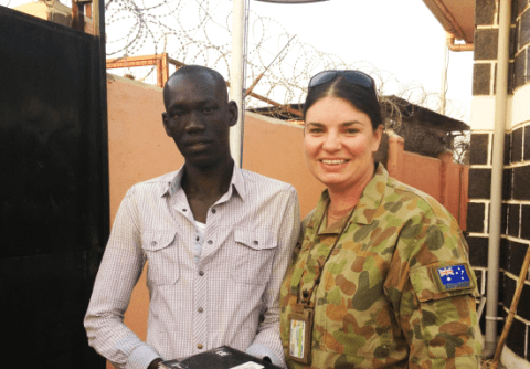
I joined the Australian Army a very long time ago and since then I’ve had a range of domestic and international appointments and deployments. Some pivotal postings include as the geospatial intelligence officer for OPERATION RESOLUTE, the whole-of-government approach to border security; and designing and establishing the Military Mapping Program for the world’s newest country as part of the United Nations Mission in South Sudan.
Most recently I was able to lead the small but mighty Foundation Military Intelligence Directorate in spearheading enterprise reform for Full Spectrum Targeting, Intelligence Mission Data and the optimisation of the Defence Geospatial Requirements and Prioritisation Framework. This included the pitch for, and establishment of, some game-changing major defence projects.
Now, as the National Location Information Branch Head at Geoscience Australia, I’m driving the delivery and enhancement of key geospatial capabilities and projects such as the Digital Atlas. I’m also working with a range of geospatial leaders across government and industry to ensure effective governance and strategic alignment as we work towards and support a cohesive vision for the future of geospatial across different sectors.
I have had the incredible pleasure and privilege to spend most of my career, whether in the military or the Australian Public Service (APS), geospatially enabling decisions makers so that they are able to make timely and relevant decisions. I’m keen to continue to lead meaningful change and reform, and I’m dedicated to positioning the geospatial community for continued progress and meaningful impacts in the years to come.
What were some of the challenges during your military deployments?
The expression ‘swimming in sensors and drowning in data’ is often used to articulate the information component of operations. There is just so much data and it is increasing daily, hourly. How do we make sense of it? In many instances, the common thread is its location in time and space – and this is as true for unstructured data as it is structured. To achieve decision advantage, commanders need timely and relevant actionable insights. They increasingly rely on geospatial professionals to achieve this by fusing multiple data sources together through their location component and running a bunch of smart analytics.
There are heaps of other challenges as well. How do we best ensure there is one common operating picture? How do we best keep that updated? How do we share classified information? How much trust do we have in the data? Have we got the right balance between investing in resource and time intensive ‘just-in-case’ data, likely to be critical to mission success, versus gathering data at the last moment when needed? Have we got enough capability and capacity in our staff? Can we grow it? Can we integrate our systems or are we air gapping everything?
Honestly, the list is near endless! However, the one common thing is that geospatial professionals are smart and innovative, especially when they are supporting operations of national importance. My greatest challenges have always been centred around how to best enable them to crack on and work their magic.
Does the military have a different approach to geospatial compared to the public and private sectors?
Yes and no. The constraints are often different, but the underlying tenets remain the same. For example, the need for Integrated Geospatial Infrastructure to connect various forms of data to underpin decision making is the same, but the data, stakeholders, security classification and time imperatives may be different. The need for robust data standards and data sharing agreements and a need to understand the level of trust in our data, is shared. The application between the APS and Defence will be different, particularly when data needs to be shared in a multi-lateral, coalition or international environment for Defence.
Resourcing issues are universal; however, in Defence, bids for additional resources will be placed in the context of how they reduce the threat profile. In the civilian or public service setting it will be in terms of benefits. But essentially, it’s the same.
I note that like Defence, the wider Australian geospatial environment is an ecosystem for both our data and our people. Without senior levels championing and some robust spatial leadership underpinned by a shared vision and a series of ‘carrots’ and ‘sticks,’ you will find duplication of effort, inefficiencies and frustration in all facets of this complex environment.
Was it hard to make the switch from military to civilian work?
It was hard to make the decision to transition. I’ve had so many opportunities and worked with super-talented people and some amazing tech and data. Stepping away from all of that wasn’t easy. But the opportunity to lead the delivery of the evolutionary Digital Atlas of Australia was too good to pass up. Once the decision was made, the transition was not so massive.
The team at Geoscience Australia probably say I brought with me a lot of acronyms and strong preference for focused discussions. I would like to think that I have continued to lead by example with authenticity, integrity, empathy, courage and a clear and considered focus — and a mantra to ‘lead, follow or get out of the way’.
My experience and learnings in ‘mission command’ would have to be one of the most valuable things I have brought to my team. This includes a clear understanding of strategic intent and making sure each team member understands their role in achieving that intent. It includes the notion of ‘schwerpunkt,’ or the ‘focus of effort to achieve decisive outcomes’, which basically means focusing your resources in an area that will lead to success. It also recognises and supports the need to fail fast and iterate.
This experience also extends to understanding strategic intent, critically analysing where we are at and what steps need to be taken to achieve that intent. This includes pitching for and then delivering major projects, geospatial or otherwise. I have had to draw on that knowledge a lot in the last year as we iteratively develop and deliver the Digital Atlas of Australia.