

Decades of seabed survey data comprising more than 1,500 individual surveys have been combined to produce a new view of the seafloor surrounding Australia.
The project has been led by Geoscience Australia in collaboration with partners James Cook University, the Australian Hydrographic Office and the University of Sydney.
“Our oceans offer increasing opportunities for economic growth, with emerging ocean industries including the offshore renewable energy sector generating new job opportunities and contributing to Australia’s future economic prosperity,” said Dr Jodie Smith, Head of the Oceans, Reefs, Coasts and the Antarctic branch at Geoscience Australia.
“This only happens with a comprehensive picture of the seabed.”
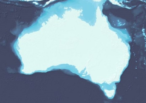
According to Dr Smith, the compilation — publicly available through the AusSeabed data portal — provides a national dataset and shows in greater detail the transition between land and sea.
The dataset’s applications will extend across a wide range of industries, such as tourism, fishing, aquaculture, renewable energy, defence, search and rescue, marine research, environmental protection and marine infrastructure.
Geoscience Australia has also produced a national seabed map and released a 3D fly through of the South Australian, Tasmanian, Victorian, New South Wales and Queensland coasts.
“The compilation allows Australia’s marine estate to be shown on a single seamless map at 250-metre resolution,” Dr Smith said.
“We can see features at a national-scale, allowing us to step back and take an informed, big-picture view of Australia in its marine context.
“Knowledge of the depth and shape of the seabed is fundamental for building ocean circulation and climate models, while also serving as a vital tool for assessing underwater hazards, sediment transport and environmental changes.”
Geoscience Australia intends to add higher-resolution datasets in high-priority areas in future release versions, such as the shallow depths that are more suitable for renewable energy development.


