Singapore to harness geospatial for climate change

By on 5 March, 2025

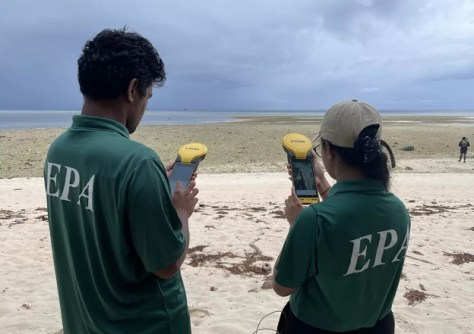
Two new research collaborations will drive geo-enabled solutions to address climate mitigation and adaptation.

Read full story • Comments { 0 }

International Women’s Day 2025

By on 5 March, 2025

IWD is coming up on Saturday, and to celebrate we spoke with three professionals from around the region.

Read full story • Comments { 0 }

Historic agreement to boost engineering surveying

By on 5 March, 2025

The GCA and Surveyors Australia will strengthen the National Engineering Surveying Certification Program.

Read full story • Comments { 0 }

NovAtel to dig deep for GNSS-denied navigation

By on 5 March, 2025

Hexagon | NovAtel aims to add enhance its GNSS+INS technology through the addition of ground-penetrating radar.

Read full story • Comments { 0 }

C.R. Kennedy, Leica intern arrives in Switzerland

By on 5 March, 2025

Phoebe Davis has begun a six-month internship with the Leica Geosystems’ GNSS team at the company’s HQ.

Read full story • Comments { 0 }

IWD 2025: Interview with Emily Tidey

By on 5 March, 2025

We’re celebrating the contributions of women in the geospatial sector. Here we speak education with Emily Tidey.

Read full story • Comments { 0 }

IWD 2025: Interview with Aurora Foo

By on 4 March, 2025

We’re celebrating the contributions of women in the geospatial sector. Here we discuss inspiration with Aurora Foo.

Read full story • Comments { 0 }

Aptella, XGRIDS partner for Australasia, SE Asia

By on 4 March, 2025

Aptella will distribute the Lixel K1 and Lixel L2 Pro handheld laser scanners in Australia, SE Asia and NZ.

Read full story • Comments { 0 }

IWD 2025: Interview with Kate Fairlie

By on 3 March, 2025

We’re celebrating the contributions of women in the geospatial sector. Here we speak land with Kate Fairlie.

Read full story • Comments { 0 }

Evolution in survey: XGRIDS and Gaussian splats

By on 1 March, 2025

Using 3DGS and SLAM technology, XGRIDS bridges the gap between accuracy, efficiency and immersive visualisation.

Read full story • Comments { 0 }

Latest Geospatial News

View all
$4.7m for coastal and marine spatial planning
Korea will work with regional bodies to enhance EO- and AI-based spatial planning across several Pacific nations.
ADVERTISEMENT
Proposed amendments to Qld surveying acts
The changes would clarify parts of the Surveyors Act 2003 and the Survey and Mapping Infrastructure Act 2003.
AI-based spatial framework for vertical greenery
An AI-based spatial framework has shown where vertical greenery is most needed in Tokyo’s high-density areas.
Vegetation map to benefit landowners, koalas
Port Stephens Council is most of the way through preparing a new vegetation map of its local government area.
Spatial Snippets for Wednesday, 5 November 2026
This week: Free GIS training, World GIS Day, job vacancies, and compensation over the sinking of NZ’s survey ship.
NISAR’s science phase to begin this month
Early images have revealed the dual-band, NASA-ISRO synthetic aperture radar satellite’s imaging strengths.
ADVERTISEMENT
Seafloor mapping of ‘eruption of the century’
Researchers have mapped the seafloor around the Hunga Volcano in Tonga, which erupted spectacularly in 2022.
How do AEC Firms in Australia easily access engineering workforce at a lower cost?
  • Sponsored Content
How do AEC Firms in Australia easily access engineering workforce at a lower cost?
Aidedo was founded based on the practical experience of CEO Aiden Tong while studying and working with many Civil Engineering and Land Surveying firms in developed countries.
Flood mapping now covers 60% of US population
NOAA’s Flood Inundation Mapping tool provides near-real-time, street-level visualisations of flood waters.

Events

View All

Featured Video

Newsletter

Sign up now to stay up to date about all the news from Spatial Source. You will get a newsletter every week with the latest news.