

Dr Zaffar Sadiq Mohamed-Ghouse is now Chair of the UN-GGIM:GS and Vice Chair of the OGC Board of Directors.
SimActive Supports Highway Ramp Expansion with Integrated Lidar and Photogrammetry
By SS Advertiser on 8 October, 2025Montreal, Canada, October 7th, 2025 – SimActive Inc., a world-leading developer of photogrammetry software, announces that its Correlator3D software is being used by Settimio Consulting Services for the engineering design of a highway ramp expansion. By combining photogrammetry and lidar data, the firm delivers highly accurate ground measurements that are essential for such projects. Settimio […]
Is Photogrammetry as Good as Lidar?
By SS Advertiser on 2 June, 2025The two primary technologies for mapping are photogrammetry and lidar. While lidar mapping is the newer of the two, does it necessarily mean it is better? The complexity of lidar lies in all the ancillary technology required to create a viable output, whereas photogrammetry needs no additional technology remaining the simpler of the two. This […]
NIWA, GNS to become the Earth Science Institute
By jnally on 21 May, 2025The two public sector Earth sciences bodies will merge to become a single entity following a government overhaul.
New NovaSAR-1 Datahub to launch later this year
By jnally on 21 May, 2025The new platform will provide enhanced capabilities and improved access to NovaSAR-1 data.
NSW, WA invite businesses to Astronautical Congress
By jnally on 21 May, 2025Space-related businesses are being invited to exhibit in the state trade pavilions at the IAC later this year.
Satellite data shows NZ’s major cities are sinking
By jnally on 20 May, 2025New satellite data shows NZ’s major cities are sinking, mean rising sea levels will affect them sooner.
Stratoship tests persistent Earth observation platform
By jnally on 20 May, 2025The company aims to reduce Australia’s dependence on foreign satellites for observation capabilities.
GCA announces special membership offer
By jnally on 20 May, 2025For a limited time, new members who join the Geospatial Council of Australia will receive six bonus weeks.
Latest Geospatial News
View all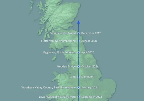
The rare alignment of true, magnetic and grid north will likely not be seen again for several centuries.
 2025-12-23
ADVERTISEMENT
The new GUI is said to make data processing faster, easier and more accessible than ever before.
2025-12-22 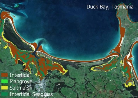
The suite uses Sentinel-2 data to produce 10-metre-resolution maps of four coastal ecosystem types.
2025-12-22 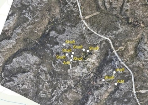
Mineral Resources Tasmania has used drones and photogrammetry to spot hazardous legacy mine features.
2025-12-19 
We hear from the CSIRO’s Dr Alex Held on what it will mean for Australia to Chair CEOS during 2026.
2025-12-19 
Once fully operational in a few months, the two spacecraft will bring the constellation total to 29 satellites.
2025-12-18
ADVERTISEMENT
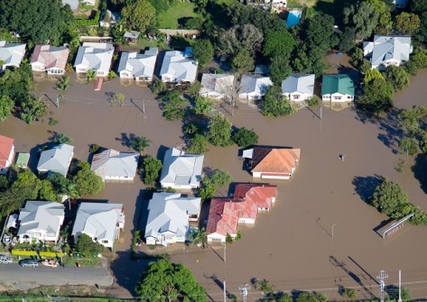
Queensland has announced the termination of the Flood Depth Time Series (Qld Government) Service.
2025-12-18 
- Sponsored Content
Aidedo was founded based on the practical experience of CEO Aiden Tong while studying and working with many Civil Engineering and Land Surveying firms in developed countries.
2026-06-02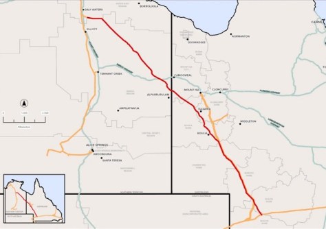
A route for a proposed new gas pipeline spanning the width of the Northern Territory, will be surveyed by APA Group.
2025-12-18 Cool Tools
View All-
 Is the Essential Eight still worth doing for your ArcGIS environment?
-
 CHC Navigation at Locate26: Connected Geospatial Solutions Across Land, Air and Water
-
 Responsible AI for better decisions: Why geospatial context matters
-
 Stop parking it: meeting the Essential Eight with ArcGIS may be more achievable than you think
Events
View All-
Nov 6
GIS in Local Government Day 2026
 Amora Hotel Adelaide, 233 Victoria Square, Adelaide
-
Nov 9
2026 Advancing Earth Observation Forum
Hobart, Tasmania -
Nov 10
SouthPAN Industry Day
Online -
Nov 13
South West and Great Southern Surveyors Conference
Mantra Bunbury Lighthouse, Bunbury, WA -
Nov 24
Locate26 Conference / 10th Digital Earth Summit
Melbourne Convention & Exhibition Centre

