

LandViewer launched by the California-based company, EOS Data Analytics, has been widely popular as a service granting access to collections of satellite imagery and analytical tools. With the recent updates it increased both the imagery catalogue and the selection of analytics for remote sensing data analysis. High-resolution imagery for enhanced remote sensing data analysis At […]
Landviewer tool for satellite remote sensing analysis gets cool updates
By SS Advertiser on 27 February, 2019Western Sydney University builds world-first space imaging system
By Spatial Source on 26 February, 2019The AstoSite event-based camera system can observe objects in space under unprecedented conditions.
Last chance to comment on CASA drone registration proposal
By Daniel Bishton on 20 February, 2019Proposed rules impose a fee on almost all UAVs weighing over 250 grams.
UAV Vision and Ascent Vision to trade as AVT Australia
By Spatial Source on 20 February, 2019UAV Vision begins trading as AVT Australia to reflect long-running partnership.
Spearing space junk: orbiting harpoon fires successfully
By Daniel Bishton on 20 February, 2019RemoveDEBRIS successfully tests another space junk removal technology.
CSIRO licenses smelting-based phosphate production
By Spatial Source on 19 February, 2019CSIRO has pioneered a phosphate production process based on ore smelting that eliminates harmful byproducts.
TERN simplifies ecological analyses with R plots package
By Daniel Bishton on 13 February, 2019AusPlotsR allows you to extract, prepare, visualise and analyse live data from over 600 monitoring sites.
Latest Geospatial News
View all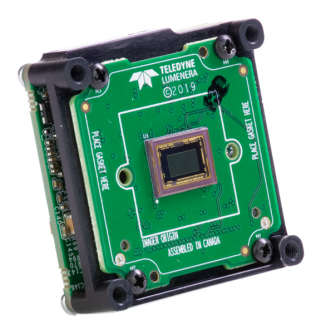
Teledyne Lumenera has announced its new series of USB3 digital cameras for scientific and industrial applications.
 2020-04-22
ADVERTISEMENT

Burning questions remain over Australia's proposed Covid-19 contact tracing app.
2020-04-22 
Spatial Source’s fortnightly round-up of the best in cartography, spatial analysis and creative applications of GIS.
2020-04-21 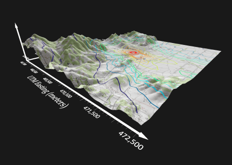
A suite of key features are overhauled in the latest version of the veteran scientific modelling and visualisation tool.
2020-04-15 
MNG appoints Sydney-based Alan Prudames as it continues its expansion east.
2020-04-15 
Recruiter urges collaboration and knowledge sharing to build a sustainable future labour force.
2020-04-15
ADVERTISEMENT
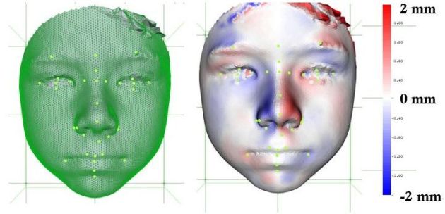
The open source tool unlocking facial clues to rare diseases with spatial techniques.
2020-04-15 
- Sponsored Content
Aidedo was founded based on the practical experience of CEO Aiden Tong while studying and working with many Civil Engineering and Land Surveying firms in developed countries.
2026-06-02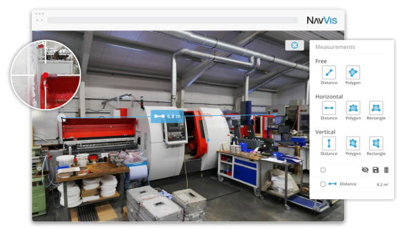
The new release features a slew of new features to increase usability and utility, facilitating accurate measurements from point clouds.
2020-04-09 



Events
View All-
Nov 9
2026 Advancing Earth Observation Forum
 Hobart, Tasmania
-
Nov 13
South West and Great Southern Surveyors Conference
Mantra Bunbury Lighthouse, Bunbury, WA -
Nov 24
Locate26 Conference / 10th Digital Earth Summit
Melbourne Convention & Exhibition Centre -
Nov 30
-
Feb 5
2026 National EISSI Awards
Melbourne Convention & Exhibition Centre

