A new exhibition showcases Melbourne's geology, with artists responding to historical geological models.

$3.8m Pacific project includes spatial learning
Australian academics will work with partners in the Solomon Islands to expand spatial science education.
Read moreLatest Geospatial News
View all
ADVERTISEMENT
Teledyne has appointed Daniel Kruimel as Regional Sales Manager for Australia and New Zealand.
 2019-08-21
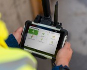
The new tablet features multi-constellation and SBAS support, modular expansion bays and Milspec certification.
 2019-08-21
Australia's geospatial intelligence agency reaches out to industry in new initiative.
 2019-08-14
The new partnership was formalised with an MoU inked on August 7 in New York.
 2019-08-14
Four Australian infrastructure projects have made the cut for Bentley's YII 2019.
 2019-08-14
ADVERTISEMENT
The constellation supporting the European Data Relay System expands with EDRS-C.
 2019-08-13
Research has found that a new approach to programming robots is needed for a new era of human-robot interaction.
 2019-08-13
 Events
View All-
Nov 24
-
Nov 26
Leica TS20 launch roadshow – Newcastle
 Rydges Newcastle, Merewether Street, Newcastle
 -
Feb 4
PNT 2026 Conference
 Royal Randwick racecourse, Sydney
 -
Feb 17
Geo Week 2026
 Colorado Convention Center, Denver
 -
Mar 4
BYDA Utility Safety Conference 2026
 RACV Club Melbourne


