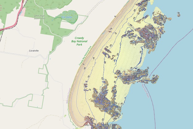
Image courtesy SEED
NSW’s coastal sea floor has been revealed in extraordinary detail in a new online seabed map viewer.
The SeaBed NSW map viewer captures the state’s entire coastline, covering 6,800 square kilometres of the coast and the sea floor to depths of up to 35 metres.
The 3D zoomable maps provide highly detailed information on the sea floor habitat, which can help with the management of marine ecosystems and coastal management programs
According to the NSW Department of Planning and Environment’s Sharing and Enabling Environmental Data in NSW (SEED) initiative, the SeaBed program “builds on the research expertise and specialist capabilities developed in 2005 as part of the HABMAP program mapping seabed habitats of our marine estate.”
“The SeaBed NSW project maps large areas of the seafloor on the inner continental shelf using airborne laser mapping (LADS) in shallow water depths and vessel-based multi-beam sonar further offshore.”
“The program contributes to the goal of a continuous high-resolution digital elevation model (DEM) for the entire NSW coast.”
The Seabed NSW program has developed and issued the following datasets:
- NSW Marine LiDAR Topo-Bathy 2018 Geotif
- NSW seabed landforms derived from marine lidar data 2022
- Shellharbour seabed landforms derived from multibeam echosounder data 2022
- Wollongong seabed landforms derived from multibeam echosounder data 2022
- HABMAP Multi-beam Survey Coverage Areas
- Single Beam Bathymetry & Coastal Topography Survey Coverage Areas – Coastal Marine Unit
- NSW Environment Multi Beam Echo Sounder Gridded Data
- NESP Biodiversity Hub Hunter Marine Park Multi Beam Echo Sounder Surveys
Stay up to date by getting stories like this delivered to your inbox.
Sign up to receive our free weekly Spatial Source newsletter.


