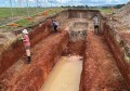
CR Kennedy True View 410 with M600
For some years now, drones have been growing in significance and are now at a place where they can contribute positively to our daily lives. Unmanned aerial vehicles (UAVs), remotely piloted aircraft (RPA), or perhaps even the remotely piloted vehicle (RPV), are here to stay, and CR Kennedy has a range of multi rotor and fixed wing solutions for mapping, aerial photography, aerial inspections, mine mapping, LIDAR and real-time surveillance. Combined with the various software packages, these solutions can produce high quality digital terrain models (DTMs), 3D models, point clouds, and orthographic photographs.

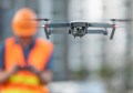
CR Kennedy Hovermap and Matrice 210
Laser scanning, LIDAR, is of course becoming more and more a viable option in the UAV world and CR Kennedy can offer various options if this level of detail, accuracy and delivery speed are required.
CR Kennedy’s UAV related product basket extends to such significant brands as Geocue PPK and LIDAR systems, DJI drones, RIEGL LIDAR, Wingtra VTOL drone, Hovermap (SLAM) LIDAR, Pix4d software, Parazero recovery systems, Blue Vigil tethers and as mentioned the Leica Aibot.
It is the case that today CR Kennedy is by far the largest distributor of drones in Australia. Through the various brands, including DJI, they currently deliver over 1000 drones throughout Australia on a monthly basis – a number that is quite illuminating in regard to drone usage in Australia today.

CR Kennedy WingtraOne before the mission
UAV ‘Hot options’
The WingtraOne is a professional VTOL fixed-wing drone used by geospatial specialists and industry workers around the world to map large areas with unprecedented image quality and accuracy. All of this now happens up to 80 percent faster than using multirotors or terrestrial surveying methods. Offering Vertical Take Off and Landing, the WingtraOne enjoys this ultimate option to massively increase your flexibility and reduce your machine wear and tear.
Hovermap is an extremely flexible 3D LiDAR-mapping and autonomy payload which can be used on anything from Drones to walking and everything in between. It enables rapid and accurate data collection without the need for GPS. When used on a UAV this allows safe flying and mapping in challenging underground, indoor and outdoor environments, without the need to send people into potentially hazardous areas.
Drone based LIDAR solutions are extremely popular these days. Replying on GPS and PPK post processing, the new from Geocue (the creators of the LOKI ppk system) True View 410 Lidar system is an ideal combination of Laser, IMU, software and dual cameras. This winning system is set to dominate the local market through a combination of performance, price point, workflow and support.
Software is vitally important in most industries these days and the UAV industry is no exception. Offering Infinity and 3D Reshaper from Hexagon Geosystems (Leica), and Pix4D software (among many others), CR Kennedy has a solution for your various requirements.
CR Kennedy is very involved in providing CASA-based training through their partnering with such industry leading companies as UAS Pacific and Aviassist.
CR Kennedy’s intention is to be your site partner and reduce any issues as much as possible. The aim is to provide customers with not just the best equipment, but a complete and fully supported solution.
Within CR Kennedy today are over 15 staff directly involved in our Survey Drone business. Many of these staff are land surveyors, all are very passionate, qualified and experienced in the operation of drones. Their primary focus is ensuring that customers enjoy maximum use and productivity of their equipment.
For more information or assistance please call 07 3862 6210 or visit our website https://survey.crkennedy.com.au/categories/_products/uav
Information provided by CR Kennedy.