

Innovation often happens when tackling the unglamorous problems no one else wants to tackle.
By Waddah Hago
At PLACE, we spend a lot of time solving problems that only show up once you’re actually in the field. One of those is image quality.
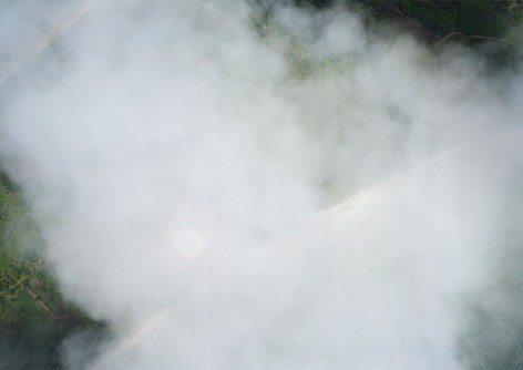
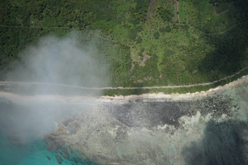
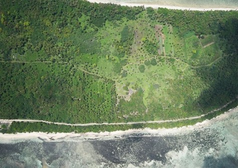
Drone missions can generate thousands of images in a single run. In BVLOS operations especially, UAVs often fly above low cloud layers, resulting in imagery that’s partially or fully compromised by haze, fogs or atmospheric conditions.
Manually reviewing and sorting those images is slow and inconsistent, and can mean discovering too late that an entire flight needs to be re-flown.
So we built something better.
The challenge
Assessing image quality at scale has traditionally been a manual, time-consuming task. Operators are left making subjective calls under time pressure, with real consequences for mission timelines, costs and data quality.
We developed an Automated Drone Image Haze Analysis System that evaluates aerial imagery quality in minutes, not hours. Using computer vision, the system automatically analyses atmospheric conditions across entire missions and delivers clear, objective reports to support fast re-flight decisions.
Built in Python and OpenCV, the system uses parallel processing via ThreadPoolExecutor and quarter-resolution optimisation for speed, while maintaining analytical accuracy through HSV colour-space analysis. The code can be explored on the GitHub Repository.
The system:
- Processes 15–50 images per second using CPU-based parallel processing;
- Applies multi-factor haze scoring (contrast, brightness, saturation);
- Generates automated CSV reports per mission;
- Supports batch processing across multiple flight folders; and
- Runs on standard field hardware — no GPU required.
The result is a process that works three to five times faster than manual review, is fully automated (i.e. no subjective judgment), provides consistent, data-driven quality assessments, and enables immediate decisions on whether and where to re-fly.
In the field
The tool proved its value during a recent mapping mission in the Kingdom of Tonga, where changing atmospheric conditions and BVLOS operations made real-time quality assessment critical. The system enabled our team to quickly identify compromised imagery, plan targeted re-flights, and significantly improve both mission efficiency and final data quality.
We are incredibly proud of the team for building something that makes our work faster, smarter and more reliable — and for proving that meaningful innovation often starts with the unglamorous problems no one else wants to tackle.
Waddah Hago is the Chief Technology Officer with PLACE .


