The Geospatial Council of Australia’s Spatial Information Day will be an immersive journey into the dynamic world of geospatial data and technology.
Delegates will have the opportunity to engage with industry leaders, renowned experts and fellow enthusiasts, while delving into the latest advancements reshaping the understanding of space and place. On the agenda will be innovative solutions driving progress across sectors such as urban planning, environment management and disaster response.

The 9th International Colloquium on Scientific and Fundamental Aspects of GNSS will bring together members of the European scientific community and their international partners involved in the use of Galileo and other GNSS in their research.
The colloquium will address several major areas of research:
- Scientific applications in meteorology, geodesy, geodynamics, geophysics, space physics, oceanography, land surface and ecosystem studies.
- Scientific developments in physics with a potential impact on future GNSS, particularly in testing fundamental laws of physics.
- Aspects of metrology such as reference frames, on board and ground clocks, precise orbit determination and time and frequency transfer.
- Scientific aspects of satellite navigation, positioning and its applications.
- Other topics of interest such as big data, IoT, novel disruptive technologies, Cubesats, HAPS, UAVs and autonomous vehicles.
- Systems and technologies for navigation in space.
Image courtesy Lockheed-Martin

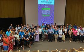
The 2024 Pacific Islands GIS & Remote Sensing Users Conference is reputably the largest GIS and remote sensing conference attended by Pacific Islanders, who leverage this annual opportunity to network and pursue partnerships with practitioners from around the globe.
The conference spotlights the latest innovative technologies, promotes knowledge and capacity development and sharing of best practices, and attracts a gathering of more than 300 attendees.
The theme for the 2024 event will be ‘Sustainable management of coastal areas through remote sensing and GIS.’


