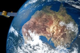
The Space & Geospatial Collaborative Workshop will be jointly hosted by the Andy Thomas Space Foundation and the Surveying and Spatial Sciences Institute in Adelaide the day following the 12th Australian Space Forum and the day before Spatial Information Day.
This inter-disciplinary workshop will provide a unique opportunity for professionals from both space and spatial sectors to:
- Learn about Australia’s renewed commitment to space technology development
- Get updates on the requirements and capabilities of the modern spatial information industry using applications such as PNT (positioning, navigation and timing), EO (Earth Observation) and telecommunications
- Connect and discuss the increasing synergy and collaborative opportunities between the two sectors.

Organised by OSGeo, this international annual gathering of location enthusiasts is the largest global gathering for geospatial software. Now in its 15th year, FOSS4G (ie. Free and Open Source Software for Geospatial) brings together developers, users, decision-makers and observers from a broad spectrum of organisations and fields of operation.
Through six days of workshops, presentations, discussions, and cooperation, FOSS4G participants create effective and relevant geospatial products, standards, and protocols. The 2021 event will be focused for the first time on South America and will be held with the close collaboration of the GeoLibres Association in Buenos Aires, Argentina.

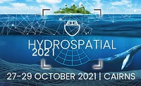
The Australasian Hydrographic Society’s HydroSpatial2021 Conference will focus on how hydrography will develop in the future, noting the development of ‘digital twinning’ and the emerging name variants for hydrography such as ‘hydrospatial’ or ‘hydrogeomatics’.
The conference theme, Hydrography of the Future, morphs two modern yet wide-ranging aspects of the hydrographic surveying profession, and should draw papers from relevant scientific, technological, operational and environmental communities. The aim is to provide delegates with valuable insights, creative ideas and inspiration on how to harness current and future technologies, systems and processes so that they can deal with present challenges and prepare for a more sustainable future.

The presenters for this topical webinar will be Dr Craig Roberts, Senior Lecturer in Surveying/GPS/Geodesy at UNSW and Wayne Patterson Director, Spatial Operations at the NSW Department of Customer Service.
Roberts will give a short update on the revision of the Australian Standard, AS_5488 Classification of subsurface utility information in the context of datum modernisation, low-cost multi-GNSS and recent advances in positioning infrastructure in Australia.
Data storage, data distribution and security are identified as challenges suggesting a reimagined data governance will be needed. Could a spatial digital twin assist? What is a spatial digital twin? Is it a BIM? Where does it come from? What is an open data policy? Who can use it? Can I use it? Which datum? How accurate is the data?
Rather than just another PowerPoint webinar, Roberts will interview Patterson in a free-flowing format. Attendees will be invited to ask their own questions live in the chat as the conversation evolves.
This webinar is targeted at surveyors, geospatial users, students and the wider spatial community.

The 16th annual congress of the Open Source Geospatial Foundation, the non-profit organisation that supports and promotes the collaborative development of free and open source geographic technologies and open geospatial data, will be held in Florence, Italy, at the Palazzo dei Congressi, Palazzo degli Affari and the University of Florence.
FOSS4G (ie. Free and Open Source Software for Geospatial) brings together developers, users, decision-makers and observers from a broad spectrum of organisations and fields of operation.

The FIG Congress — the largest and most prestigious conference of surveying and geospatial professionals — will this year be held in Poland.
The organisers are expecting an attendance of 1,000 to 1,500 surveying and geospatial experts from all over the world.
This year the local host is the Association of Polish Surveyors, and the conference theme is ‘Volunteering for the future – Geospatial excellence for a better living’. Geospatial excellence and all related professions and topics are now seen in a much broader context and as public goods and beneficial for the well-being and betterment of the entire society.
The sub themes are:
- Surveyor 4.0
- The surveying profession in and after COVID times
- Open access to data
- Surveying competence for other disciplines
The FIG Congress 2022 will give passionate professionals the opportunity to:
- Learn globally, with participation from around 80 to 90 countries
- Learn across silos, from other countries, industries and professional roles – with sessions and representation from a broad range of surveyors and geospatial experts
- Have influence on careers, organisations and communities

The Committee of Experts on Global Geospatial Information Management (UN-GGIM) will convene the second United Nations World Geospatial Information Congress (UNWGIC) in Hyderabad, India from 10-14 October 2022.
Hosted by the Government of India through its Ministry of Science and Technology, the convening of the UNWGIC arises out of the mandate from the United Nations Economic and Social Council (ECOSOC) to the Committee of Experts to convene global forums to promote comprehensive dialogue on global geospatial information management with all relevant governments, international organisations and stakeholders.
With an overarching theme ‘Geo-Enabling the Global Village: No one should be left behind,’ the second UNWGIC will reflect the importance of integrated geospatial information to support sustainable development and the wellbeing of society, address environmental and climate challenges, embrace digital transformation and technological development, and catalyse vibrant economies.
The congress addresses the development and strengthening of integrated geospatial information management, its capacities and capabilities, and demonstrates the importance of international cooperation and coordination for building a human data and geography community, against the three pillars of sustainable development, for a shared future and a better world, leaving no one behind within an inclusive and equitable global society.
The UNWGIC will feature a high-level, plenary, special and parallel sessions. While the actual second UNWGIC program covers three days (11 – 13 October), the overall event will be a weeklong (10 – 14 October), and will include global and regional meetings, workshops and learning events, expert meetings and side events, including the eleventh plenary meeting of the Regional Committee of United Nations Global Geospatial Information Management for Asia and the Pacific (UN-GGIM-AP), as well as the annual meeting of the UN-GGIM Expanded Bureau.

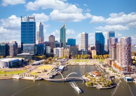
The WA geospatial community will come together on 16 February 2022 to learn, network, share experiences and catch up with colleagues old and new.
The WA Asia-Pacific Spatial Excellence Awards dinner will also be held in conjunction with the conference, celebrating the outstanding work being undertaken across the region during 2022.
Image credit: ©stock.adobe.com/au/anekoho
The Geo Connect Asia conference provides a strategic and collaborative platform for industry professionals, government agencies and start-ups to come together to build and develop knowledge and solutions for Asia’s geospatial & location intelligence markets. It also comprises panel sessions to provide interactive responses to real and current challenges.
Geo Connect Asia 2023 (GCA 2023) will have full focus on a face-to-face show format, featuring more hands-on opportunities for visitors to experience different elements, modules and applications of geospatial data.
GCA 2023 will also see the launch of a dedicated UAV-focused industry show, Drones Asia, covering an entire hall with several on-site showcases of drones, cameras, launch & recovery systems, and sensors, as well as the latest technology for satellite & remote sensing, launch & recovery systems, surveillance & reconnaissance, and training & simulation.
Geo Connect Asia is your gateway to meeting some of the world’s biggest players in geospatial technology and location intelligence solutions, right at the heart of Singapore.
Key Industries
![]()
![]()
![]()
![]()
![]()
![]()
![]()
![]()
![]()
If you are interested in knowing about conference sponsorship opportunities and/or meeting spaces at GCA 2023, please contact Rupert.Owen@montgomeryasia.com.

Now in its 14th edition, Geospatial World Forum (GWF) has become a not-to-be-missed conference for professionals engaged in geospatial and allied sectors. It is a collaborative and interactive platform that demonstrates the collective and shared vision of the global geospatial community.
GWF is an annual gathering of geospatial professionals and leaders representing the entire ecosystem of public policies, national mapping agencies, private sector enterprises, multilateral and development organisations, scientific and academic institutions, and large end-users from government businesses and citizen services.


