The presenters for this topical webinar will be Dr Craig Roberts, Senior Lecturer in Surveying/GPS/Geodesy at UNSW and Wayne Patterson Director, Spatial Operations at the NSW Department of Customer Service.
Roberts will give a short update on the revision of the Australian Standard, AS_5488 Classification of subsurface utility information in the context of datum modernisation, low-cost multi-GNSS and recent advances in positioning infrastructure in Australia.
Data storage, data distribution and security are identified as challenges suggesting a reimagined data governance will be needed. Could a spatial digital twin assist? What is a spatial digital twin? Is it a BIM? Where does it come from? What is an open data policy? Who can use it? Can I use it? Which datum? How accurate is the data?
Rather than just another PowerPoint webinar, Roberts will interview Patterson in a free-flowing format. Attendees will be invited to ask their own questions live in the chat as the conversation evolves.
This webinar is targeted at surveyors, geospatial users, students and the wider spatial community.

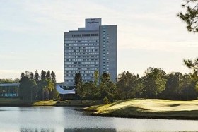
The Australian Institute of Mine Surveyors (AIMS) National Conference will be held from 25 to and 27 May 2022 at the RACV Royal Pines Resort Gold Coast, Queensland.
The conference will begin on the Wednesday with optional workshops and a welcome dinner, followed the next day by a full program of sessions on a range of topics plus networking with sponsors within the network market place. There will have a final dinner on Thursday evening at the hotel, while Friday will again see a full day of conferring and networking.
Well-known comedian Elliot Goblet (described as “one of the most original comedians in the history of the known universe”) will be the MC for the welcome dinner, while the equally well-known sporting personality Sam Kekovich has been confirmed as the keynote speaker (“you know it makes sense”).
Image credit: RACV

The Australian Institute of Mine Surveyors (AIMS) Mudgee Regional Seminar will be held at Parklands Resort, Mudgee, NSW, on 22 March 2024. There will also be an optional dinner at a local brewery the evening prior.
This annual event is always very well attended, and features presentations on a wide variety of mine surveying topics and technologies. You can read an account of the 2023 seminar on the AIMS website.

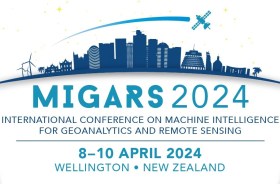
The International Association of the IEEE-Geoscience and Remote Sensing Society (GRSS), the IEEE-Computational Intelligence Society (CIS) and the local organising committee invite geospatial and computing professionals to attend the International Conference on Machine Intelligence for GeoAnalytics and Remote Sensing (MIGARS) to be held in Wellington, Aotearoa New Zealand in April 2024.
MIGARS aims to explore the interface of machine intelligence approaches with geosciences, spatial analytics, and remote sensing. With the tremendous developments in remote sensing technology, data acquisitions and sensing platforms, digital data have grown leaps and bounds to stream and are too big by volume, variety, and veracity. The challenge is handling, processing, and automating geo-data from various sources, such as multi-platform remote sensors and IoT devices, informing decision-making and monitoring our planet.
The conference will focus on connecting researchers from various disciplines, including computation/artificial intelligence, engineering, remote sensing, hydrology, agriculture and geosciences, and look for the potential use of intelligent computational approaches for geo-data-based applications and for serving society at large.


