Held on Sunday, 9th February, 2020, the SSSI National Bushfire Recovery Map-a-thon was a way for the national and international community to work together to map a total of 2,793,879 hectares affected by recent Australian bushfires with the focus being on burnt infrastructure. Join us for this Webinar to hear more about the initiative.
Speakers:
Dr Lesley Arnold (SSSI National Board Director) will give an overview of the Map-a-thon initiative and discuss overall logistics of planning; industry, government and NGO engagement; the challenges and overall execution of the event.
Nathan Eaton, Executive Director, NGIS Australia will give an overview of the technical set-up of this mammoth Map-a-thon and highlight some of the challenges and triumphs experienced.
This is a free event open to those who participated in the Map-a-thon or are involved in the surveying and spatial community.
Details about how to join the Webinar will be emailed to you prior to the event.
To read more about the SSSI National Bushfire Recovery Map-a-thon see the news item here

The ITS Australia Summit 2022 in Brisbane will feature a strong industry program over three days driven by abstract submissions & invited keynote presentations, and will include technical tours & demonstrations, cutting edge industry exhibition, workshops, panel discussions, and an exciting social program.
As Australia’s leading transport technology event, Summit will demonstrate new insights and initiatives that will determine our path toward an accessible and automated future transport network.

The IGNSS Association’s biennial international GNSS conference will return to UNSW Sydney from 7 to 9 February, 2024, where it will celebrate the first half-century of GNSS and look ahead to the next 50 years.
IGNSS 2024 will bring together experts, policy makers and emerging leaders from across the globe to examine the latest advances, present cutting edge research and discuss policy, market development and infrastructure.
The conference will also showcase Australia and New Zealand’s Southern Positioning Augmentation Network (SouthPAN), along with developments by other countries across the Asia-Pacific.
Topics to be covered at the conference will include:
- Autonomy on land, air, sea and in space
- Aviation and avionics
- Cooperative Intelligent Transport Systems
- Machine guidance applications in agriculture, construction and mining
- Maritime applications
- Uncrewed aerial systems
- Space applications of PNT in Earth orbit and for lunar and Martian exploration
- Positioning infrastructure
- GNSS vulnerability, resilience and risk
- Interference detection and mitigation
- Policies and standards
- SBAS and other augmentations
- Datums and geodesy
- National and international GNSS developments
- Emerging application areas for GNSS
- Key industries and their reliance on GNSS
- The multi-GNSS era
- Cyber security in PNT applications and infrastructure
- Alternative PNT
- State of the art in PNT algorithms and software development
- GNSS aiding and sensor fusion
- Positioning in GNSS denied environments
- Development of GNSS receiver hardware and firmware
- Precise position using smartphones
The organisers are encouraging early career researchers and industry representatives to present their work. The abstract submission process will open soon — keep an eye on the IGNSS website for announcements.
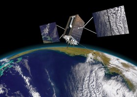
Image courtesy Lockheed-Martin


