Discover what’s new and what’s next in HDS technology with immersive sessions and a day dedicated to learning, led by Leica Geosystems experts.
The HDS User Conference is designed to deliver a new experience for all attendees from Australia and New Zealand.
Together with our partners C.R. Kennedy and Global Survey the HDS User Conference will bring together Leica Geosystem HDS users in a community environment where they’ll access training sessions, learn about our latest innovations, listen to best practices from industry and experience live demos of the latest HDS technology and solutions.
The HDS User Conference features insightful keynote addresses, customer success stories and HDS dedicated group training sessions. Discover and test-drive new, innovative hardware and software solutions that will improve the performance, speed, workflows and efficiency across your organisation.
SEE AGENDA
Reasons to attend:
- Experience the latest solutions that will help you compete and win in today’s dynamic environment
- Learn about reality capture hardware and software solutions and how to be more efficient and productive
- Leica Geosystems will unveil several new innovations and attendees will get a first-hand look at the latest technology advancements
- Experience hands-on demonstrations and training to improve your workflows
- Learn from and network with peers across industries
What’s included in your registration:
- Two days filled with informative sessions and networking opportunities plus a dedicated day to learning
- Evening welcome cocktail reception
- Post-conference access to training material and presentations
- Morning tea, lunch and afternoon tea catering
- Delegate bags
NOTE: We ask that you select your preferred training session time when registering. Simply choose from the four session times available, per workshop.
This helps us manage classroom numbers to ensure we provide you with quality training sessions and you will have the opportunity to attend each topic throughout day two of the conference.
Day two- August 15
Workshop sessions and timings
Maximising 3DReshaper
9am – 10:30am I 11am- 12:30pm I 1:30pm-3:00pm I 3:30pm-5:00pm
Advanced data management and registration workflow
9am – 10:30am I 11am- 12:30pm I 1:30pm-3:00pm I 3:30pm-5:00pm
Creating diverse deliverables: optimising the latest Leica HDS software updates to transform point cloud data into value- added deliverables
9am – 10:30am I 11am- 12:30pm I 1:30pm-3:00pm I 3:30pm-5:00pm
BIM workflow
9am – 10:30am I 11am- 12:30pm I 1:30pm-3:00pm I 3:30pm-5:00pm
Visit the event page for more information
If you have any questions about the HDS User Conference, training sessions, or assistance regarding registration, please contact:
Tamara Stakic
Marketing Manager
info.anz.geo@leica-geosystems.com
T: +61 3 9914 2262

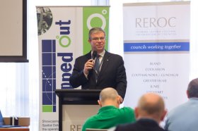
The latest in spatial data applications will be showcased at this year’s Mapped Out Conference to be held at the Rules Club in Wagga Wagga on Wednesday 2 & Thursday 3 March 2022.
Mapped Out will highlight the diversity of applications for spatial data, geographic information systems and their supporting technologies. Guest speakers with local and national experience will be showcasing the use of spatial data to enhance the operation and delivery of government services.
The Conference is a great opportunity for people working in regional NSW in both local government and the private sector to keep abreast of the latest technology and geographical information systems that can be utilised in their day to day work.

The FIG Congress — the largest and most prestigious conference of surveying and geospatial professionals — will this year be held in Poland.
The organisers are expecting an attendance of 1,000 to 1,500 surveying and geospatial experts from all over the world.
This year the local host is the Association of Polish Surveyors, and the conference theme is ‘Volunteering for the future – Geospatial excellence for a better living’. Geospatial excellence and all related professions and topics are now seen in a much broader context and as public goods and beneficial for the well-being and betterment of the entire society.
The sub themes are:
- Surveyor 4.0
- The surveying profession in and after COVID times
- Open access to data
- Surveying competence for other disciplines
The FIG Congress 2022 will give passionate professionals the opportunity to:
- Learn globally, with participation from around 80 to 90 countries
- Learn across silos, from other countries, industries and professional roles – with sessions and representation from a broad range of surveyors and geospatial experts
- Have influence on careers, organisations and communities

The overall theme for the FIG Working Week 2023 will be ‘Protecting our world, conquering new frontiers,’ which refers to the importance of looking ahead and discovering what will be needed in the future for our profession and at the same time make sure to preserve what works well today.
The FIG Working Week 2023 will give passionate professionals the opportunity to:
- Learn globally, with participation from around 80 to 90 countries.
- Learn across silos, from other countries, industries and professional roles, with sessions and representation from the broad range of surveyors and geospatial experts.
- Make impacts on careers, organisations and communities.

Hosted by the Riverina Eastern Regional Organisation of Councils and the Riverina Spatial Information Group, Mapped Out 2023 will bring together public- and private-sector professionals to learn about the latest geospatial developments.
Mapped Out will highlight the diversity of applications for spatial data, geographic information systems and their supporting technologies. Guest speakers with local and national experience will be showcasing the use of spatial data to enhance the operation and delivery of government services.
The Conference is a great opportunity for people working in regional NSW in both local government and the private sector to keep abreast of the latest technology and geographical information systems that can be utilised in their day-to-day work.

The 2024 edition of the International Conference on Geographical Information Systems Theory, Applications and Management (GISTAM 2024) aims to create a meeting point of researchers and practitioners that address new challenges in geo-spatial data sensing, observation, representation, processing, visualization, sharing and managing, in all aspects concerning both ICT as well as management information systems and knowledge-based systems.
The conference welcomes original papers of either practical or theoretical nature, presenting research or applications, of specialised or interdisciplinary nature, addressing any aspect of geographic information systems and technologies, such as:
- Data acquisition and processing
- Remote sensing
- Interaction with spatial-temporal information
- Spatial data mining
- Managing spatial data
- Modelling, representation and visualisation
- GIS and climate change
- Domain applications


