The 10th Land Administration Domain Model Workshop (LADM 2022) will be held in Dubrovnik, Croatia from 31 March to 2 April 2022. This is an on-site event at Hotel Dubrovnik Palace, with possibilities for remote participation. The workshop is being organised in conjunction with 7th Croatian Congress on Cadastre.
Image credit: ©stock.adobe.com/au/incomible

Since the establishment of Scott Base on Ross Island by the late Sir Edmund Hillary in 1957, surveyors have been appointed to assist scientists with survey related tasks on the ice.
This presentation by a panel of Antarctic surveyors promises to be educational, entertaining and informative, as they talk about their experiences on projects on the frozen continent over the last 35-plus years.
Image credit: ©stock.adobe.com/au/hrathke

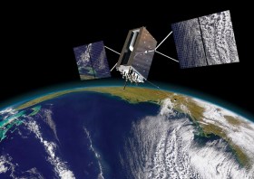
The IGNSS Association’s biennial international GNSS conference will return to UNSW Sydney from 7 to 9 February, 2024, where it will celebrate the first half-century of GNSS and look ahead to the next 50 years.
IGNSS 2024 will bring together experts, policy makers and emerging leaders from across the globe to examine the latest advances, present cutting edge research and discuss policy, market development and infrastructure.
The conference will also showcase Australia and New Zealand’s Southern Positioning Augmentation Network (SouthPAN), along with developments by other countries across the Asia-Pacific.
Topics to be covered at the conference will include:
- Autonomy on land, air, sea and in space
- Aviation and avionics
- Cooperative Intelligent Transport Systems
- Machine guidance applications in agriculture, construction and mining
- Maritime applications
- Uncrewed aerial systems
- Space applications of PNT in Earth orbit and for lunar and Martian exploration
- Positioning infrastructure
- GNSS vulnerability, resilience and risk
- Interference detection and mitigation
- Policies and standards
- SBAS and other augmentations
- Datums and geodesy
- National and international GNSS developments
- Emerging application areas for GNSS
- Key industries and their reliance on GNSS
- The multi-GNSS era
- Cyber security in PNT applications and infrastructure
- Alternative PNT
- State of the art in PNT algorithms and software development
- GNSS aiding and sensor fusion
- Positioning in GNSS denied environments
- Development of GNSS receiver hardware and firmware
- Precise position using smartphones
The organisers are encouraging early career researchers and industry representatives to present their work. The abstract submission process will open soon — keep an eye on the IGNSS website for announcements.
Image courtesy Lockheed-Martin

The 3rd International Land Management Conference, hosted by the University of the West of England, will be held online on 14 and 15 March 2024. The event will bring together experts and professionals in land management to discuss inclusive land tenure, efficient land markets, sector reform and innovations in land research.
The conference will focus on four themes:
- Theme 1: Can we build more inclusive and resilient land tenure systems by understanding social value and climate change?
- Theme 2: How can land administration systems contribute to efficient and equitable land markets?
- Theme 3: What approaches can Development Partners use to help achieve more successful Land Administration sector reform?
- Theme 4: LINK – Early Career Professionals and Junior Researchers – Innovations in Land Research and Practice
The conference is organised by LINK, the Land–International Network for Knowledge — a network of academic organisations, professional practice and development partners, as well as public and private sector country partners — in association with the University of the West of England.

The Institute of Navigation’s (ION) Pacific PNT Conference is a global event dedicated to the cooperative development of positioning, navigation and timing technology and applications.
The conference attracts policy and technical leaders from Japan, Singapore, China, South Korea, Australia, the United States and many other countries, who meet to discuss policy updates, receive program status updates and exchange technical information.
The conference will cover a wide range of topics:
- GNSS policy/status
- Polynesian navigation
- Aircraft navigation and surveillance
- Algorithms and methods
- Alternative navigation and signals of opportunity
- Aviation applications of GNSS
- Challenging navigation problems
- Emerging PNT consumer applications
- GNSS-R and GNSS-RO for environmental monitoring
- High-precision GNSS correction and monitoring networks
- Inertial navigation technology and applications
- Interference and spectrum
- Ionosphere monitoring with GNSS
- Natural hazards detection and other remote sensing applications
- Time and frequency distribution
- Space navigation technologies
Substantial discounts are available for early registrations.


