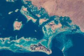
During GEO Week 2021, the Group on Earth Observations will present the multidisciplinary activities of the GEO Work Programme that address policy agendas involved in the UN Framework Convention on Climate Change (UNFCCC) COP26, the Convention on Biological Diversity (CBD) COP15, the UN Decade of Ocean Science for Sustainable Development and the UN Decade of Ecosystem Restoration.
The online event will include the GEO-17 plenary, plus anchor and side events. Time will be scheduled each day for virtual networking. On Monday, November 22, the 56th Executive Committee will be held as a closed meeting.
Of particular importance will be the anchor events: These are the main events designed by GEO week 2021 organisers to explain the multidisciplinary nature of GEO through the concept of nexus thinking. Working on multiple topics simultaneously is essential in today’s rapidly changing environmental and social conditions. For example, work in one area will have a knock-on effect or impact in another area, such as the water, energy and food nexus. These events are linked to the global policy agendas that underpin most of GEO’s work.
Image credit: NASA

The Institution of Surveyors NSW (ISNSW) Annual Conference (formerly Australia Day Seminar) is the premier ISNSW event. Held annually, this two-day conference attracts over 400 surveyors from metropolitan and regional areas of New South Wales.
The conference content will address pressing issues common to surveyors working in New South Wales, and offers a quality, value for money education and networking experience covering a range of topics.
Throughout history, surveyors have remained the pioneers of discovery shaping our world to its current existence by exploring the unknown on earth and in space. Fast forward to 2013 when the signing of the Budapest declaration created a common worldwide celebration for those leaders, past and present.
Global Surveyors’ Day is a way to globally recognise the ground-breakers, pioneers, individuals and the industry that has shaped our history and continues to be the foundation of our communities.
Image credit: ©stock.adobe.com/au/Yuttana Studio
The Country Surveyors Association of NSW Annual Easter Conference will be held on 22 and 23 April 2002, in association with Consulting Surveyors NSW, at the Remington Hotel, Orange, and online.
The program includes an update from the NSW Surveyor General; other legislative, regulatory, training and cybersecurity updates; and case studies covering a variety of topics, eg. ‘Sealing the Silver City and Cobb Highways’ and ‘NT Surveying Tales & Section 19 Leases under Aboriginal Land Rights Act’. Other topics to be covered include mining lease surveys, seismic surveys, and the REAP scheme.
There will be a technical tour, dinner at the Borrodell Vineyard, and presentations from media personalities Dr Karl Kruszelnicki and Pip Courtney.
The full two-day registration includes Friday and Saturday evening meals. A Partners Program is additional. 5 CAD and 10 SP points apply.

Survey and Spatial NZ’s 2022 conference will be held from 1 to 3 August at the Novotel Lakeside, Rotorua. The conference is the biggest continuing professional development event of the year for NZ surveying and spatial professionals. It invites sharing of knowledge amongst peers, bringing together networking opportunities for all delegates and is an essential event for professional development and connectivity within the sector.
The choice of Rotorua as the location is apt, given the conference theme of ‘Turning up the Heat’. The organisers aim to stimulate discussion regarding challenges in regional areas, which include climate change and developments outside of Auckland.

The FIG Congress — the largest and most prestigious conference of surveying and geospatial professionals — will this year be held in Poland.
The organisers are expecting an attendance of 1,000 to 1,500 surveying and geospatial experts from all over the world.
This year the local host is the Association of Polish Surveyors, and the conference theme is ‘Volunteering for the future – Geospatial excellence for a better living’. Geospatial excellence and all related professions and topics are now seen in a much broader context and as public goods and beneficial for the well-being and betterment of the entire society.
The sub themes are:
- Surveyor 4.0
- The surveying profession in and after COVID times
- Open access to data
- Surveying competence for other disciplines
The FIG Congress 2022 will give passionate professionals the opportunity to:
- Learn globally, with participation from around 80 to 90 countries
- Learn across silos, from other countries, industries and professional roles – with sessions and representation from a broad range of surveyors and geospatial experts
- Have influence on careers, organisations and communities

The Association of Public Authority Surveyors, NSW (APAS) annual conference for 2023 will be held at Opal Cove Resort in Coffs Harbour, from 20 to 22 March 2023.
The theme for the event will the ‘Pirates of the Cadastre’. The program is being developed, with a call for abstracts currently in place (as of June 2022).
Important dates and deadlines to note, are:
- Abstract submission deadline: Friday, 23 September 2022
- Draft paper deadline: Friday, 18 November 2022
- Final paper deadline: Friday, 20 January 2023

Throughout history, surveyors have remained the pioneers of discovery shaping our world to its current existence by exploring the unknown on earth and in space. Fast forward to 2013 when the signing of the Budapest declaration created a common worldwide celebration for those leaders, past and present.
Global Surveyors’ Day is a way to globally recognise the ground-breakers, pioneers, individuals and the industry that has shaped our history and continues to be the foundation of our communities.
Image credit: ©stock.adobe.com/au/Yuttana Studio

The Local Government Spatial Reference Group (LGSRG) will be holding a webinar on Monday, 4 September, to introduce a series of hands-on workshops it will be holding across Victoria during September 2023.
The webinar will cover the topic of Best Practice Geospatial Intelligence for Climate Impact, and will address important topics on climate impact, community safety and how geospatial intelligence can contribute to better outcomes for local governments.
The LGSRG was formed in 2003 to address the need for a sector wide group representing the strategic interests of the Victorian Local Government sector with respect to spatial information. The LGSRG has been active throughout the COVID pandemic to keep the local government geospatial community connected and engaged via the annual Spatial Capability Workshop series which have grown year on year, and is now diversifying with a quarterly Spatial Hour webinar to share stories of success within the local government geospatial sector.
Image credit: ©stock.adobe.com/au/yutthana

The 3rd International Land Management Conference, hosted by the University of the West of England, will be held online on 14 and 15 March 2024. The event will bring together experts and professionals in land management to discuss inclusive land tenure, efficient land markets, sector reform and innovations in land research.
The conference will focus on four themes:
- Theme 1: Can we build more inclusive and resilient land tenure systems by understanding social value and climate change?
- Theme 2: How can land administration systems contribute to efficient and equitable land markets?
- Theme 3: What approaches can Development Partners use to help achieve more successful Land Administration sector reform?
- Theme 4: LINK – Early Career Professionals and Junior Researchers – Innovations in Land Research and Practice
The conference is organised by LINK, the Land–International Network for Knowledge — a network of academic organisations, professional practice and development partners, as well as public and private sector country partners — in association with the University of the West of England.


