Throughout our special coverage of Smarter Data Smarter World (SDSW), you will see how organisations are sharing and using trusted geospatial data to achieve sustainability and Net Zero goals. Hear from industry experts around the world about the latest innovations and how we are all collaborating, to make the world safer, smarter and more sustainable.
- Sustainability: We are all striving to sustainably meet the changing data needs and expectations of our users, stakeholders, and regulators, whilst reducing our ecological footprint. See how the adoption of smarter technology can help achieve sustainability goals.
- Innovation: Data is at the centre of businesses and that data increasingly must be accurate, first time and every time it’s required. Hear how organisations are using innovative solutions to create and make available accurate and timely data, for data-led decision making.
- Collaboration: Multiple data sources and multiple data users and stakeholders emphasise the need for up-to-date data at the touch of a button. Discover how through collaboration and engagement businesses are saving time, money, and effort, while increasing productivity.
For those attendees who are members of the Surveying & Spatial Sciences Institute, this webinar is worth 1 SSSI CPD point.
Put your pedal to the FMEdal and join us for the FME World Tour 2022!

Is your data driving you crazy? Overtake the competition with FME 2022! Register now to join us in a city near you. Whether you’re a newbie, just discovering the power of FME or an expert and hungry for new functionality, these fun events should be in your calendar!
Take a look at some of the most popular reasons to attend a World Tour event near you:
- Hear customer success stories and gain valuable insight on data integration strategies
- Get up to speed with FME 2022 new capabilities
- Our FME Pit Crew “Certified professionals” will be on the ground to answer any questions you may have.
- Plus lots of great prizes to be won!
The Australasian Hydrographic Society NZ Region, in conjunction with the Space & Spatial New Zealand Hydrography Stream, are holding a 1-day seminar on Friday, 8 July 2022 at the Miramar Golf Club, Wellington.
The seminar will align closely with the IHO’s World Hydrography Day theme “Hydrography – contributing to the United Nations Ocean Decade”.

Survey and Spatial NZ’s 2022 conference will be held from 1 to 3 August at the Novotel Lakeside, Rotorua. The conference is the biggest continuing professional development event of the year for NZ surveying and spatial professionals. It invites sharing of knowledge amongst peers, bringing together networking opportunities for all delegates and is an essential event for professional development and connectivity within the sector.
The choice of Rotorua as the location is apt, given the conference theme of ‘Turning up the Heat’. The organisers aim to stimulate discussion regarding challenges in regional areas, which include climate change and developments outside of Auckland.

Registrations for 1Spatial’s Annual Breakfast Seminar 2022 are open!
We would love to invite you to join our 3rd Annual Breakfast Seminar 2022 this October, which has limited number of seats available.
We are delighted to say that this event will be back in-person, around Australia!
Throughout the event, you will hear both customer and industry presentations that will focus on the challenges and opportunities for using and sharing geospatial data. There will be panel discussions and opportunities to network with your peers, our team, and other industry experts.
Building and Sustaining your Data Foundations
Strong data foundations are an essential requirement for the effective management of asset information and decision-making. Data needs to be accessible to organisations and their supply chain, to enable them to understand what information they have and need, what data can be upcycled sustainably, where data is located and who has access to it. To create good foundations that allow organisations to have confidence in their data, the quality, management and maintenance of that data is critical. Join us to find out more!
We look forward to welcoming you,
The 1Spatial Team
Join 1Spatial on our World Tour featuring FME!
BUILDING YOUR DATA FOUNDATIONS
The power is all yours; building stronger foundations, constructing the perfect data integration platform, and empowering the end-user all at a touch of a button. Register now!
1Spatial is hosting our very own World Tour, featuring FME. And it’s with great pleasure to be kick-starting this epic event in Australia, followed by Singapore, US and the UK!
During this Tour event, you’ll hear about the importance of foundation data and how customers trust 1Spatial’s wide range of products and solutions. You will learn how they are being used by clients all around the world and how they are saving time and money.
We are delighted to have Bob Chell, 1Spatial’s Chief Product Officer (CPO) from the UK joining the event to talk about the 1Spatial Products and how they are being used around the world.

Australian Tour dates – Register now!
- Perth – 08th May | DoubleTree by Hilton Perth Waterfront
- Adelaide – 9th May | Adelaide Convention Centre
- Hobart – 15th May | RACV Hobart Hotel
- Melbourne – 16th May Melbourne Marriott Hotel
- Canberra – 17th May | QT Canberra
- Brisbane – 18th May | Sofitel Brisbane Central
- Sydney – 19th May | Sheraton Grand Sydney Hyde Park
- Singapore – 30th May |Sheraton Towers Singapore
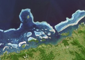
Hydrographers and all those with an interest in hydrography and related disciplines, are invited to attend a World Hydrography Day 2023 Seminar in Suva, Fiji, on 22 and 23 June.
The seminar will be held jointly by the Australasian Hydrographic Society and the Fiji Hydrographic Service. The venue will be the Moana Anglican Services and Teaching Centre at St John the Baptist Theological College.
The organisers are calling for potential sponsors and presenters to get in touch.
The theme for World Hydrography Day 2023 is ‘Hydrography: Contributing to the United Nations Ocean Decade’.
The seminar comes after a two-year pause due to the COVID pandemic and associated travel restrictions. It will provide an opportunity for professionals to network and share hydrospatial knowledge through presentations and discussion.
It is also intended that the presentations will highlight the empowerment of women within the hydrography field.
Registration is free but places are limited. Registrations must be secured by close of business, Tuesday, 20 June 2023.

The Local Government Spatial Reference Group (LGSRG) will be holding a webinar on Monday, 4 September, to introduce a series of hands-on workshops it will be holding across Victoria during September 2023.
The webinar will cover the topic of Best Practice Geospatial Intelligence for Climate Impact, and will address important topics on climate impact, community safety and how geospatial intelligence can contribute to better outcomes for local governments.
The LGSRG was formed in 2003 to address the need for a sector wide group representing the strategic interests of the Victorian Local Government sector with respect to spatial information. The LGSRG has been active throughout the COVID pandemic to keep the local government geospatial community connected and engaged via the annual Spatial Capability Workshop series which have grown year on year, and is now diversifying with a quarterly Spatial Hour webinar to share stories of success within the local government geospatial sector.
Image credit: ©stock.adobe.com/au/yutthana
The Remote Hydrography conference and exhibition brings together manufacturers, operators, regulators, and research and development leaders from both industry and academia, within the field of remote surveying and uncrewed survey operations.
Remote Hydrography 2024 provides an opportunity to share experience gained in the development and application of autonomous and uncrewed platforms (surface, underwater, aerial and space-based) and the associated command and support services.
These and enabling technologies like machine learning and artificial intelligence will revolutionise workflows for hydrographic data collection, processing, analysis and presentation.

The 3rd International Land Management Conference, hosted by the University of the West of England, will be held online on 14 and 15 March 2024. The event will bring together experts and professionals in land management to discuss inclusive land tenure, efficient land markets, sector reform and innovations in land research.
The conference will focus on four themes:
- Theme 1: Can we build more inclusive and resilient land tenure systems by understanding social value and climate change?
- Theme 2: How can land administration systems contribute to efficient and equitable land markets?
- Theme 3: What approaches can Development Partners use to help achieve more successful Land Administration sector reform?
- Theme 4: LINK – Early Career Professionals and Junior Researchers – Innovations in Land Research and Practice
The conference is organised by LINK, the Land–International Network for Knowledge — a network of academic organisations, professional practice and development partners, as well as public and private sector country partners — in association with the University of the West of England.


