During GEO Week 2021, the Group on Earth Observations will present the multidisciplinary activities of the GEO Work Programme that address policy agendas involved in the UN Framework Convention on Climate Change (UNFCCC) COP26, the Convention on Biological Diversity (CBD) COP15, the UN Decade of Ocean Science for Sustainable Development and the UN Decade of Ecosystem Restoration.
The online event will include the GEO-17 plenary, plus anchor and side events. Time will be scheduled each day for virtual networking. On Monday, November 22, the 56th Executive Committee will be held as a closed meeting.
Of particular importance will be the anchor events: These are the main events designed by GEO week 2021 organisers to explain the multidisciplinary nature of GEO through the concept of nexus thinking. Working on multiple topics simultaneously is essential in today’s rapidly changing environmental and social conditions. For example, work in one area will have a knock-on effect or impact in another area, such as the water, energy and food nexus. These events are linked to the global policy agendas that underpin most of GEO’s work.
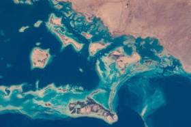
Image credit: NASA

On behalf of the Locate Australia Conferences it is our pleasure to invite you to join us at Locate22, 24 – 26 May in Canberra, Australian Capital Territory.
Locate22 returns to the Nation’s Capital in the traditional format of a live event at the National Convention Centre Canberra (NCCC). With the ability to be COVID safe, within a socially distanced environment, the NCCC is the perfect venue for Australia’s premier spatial and surveying conference. Canberra brings an incomparable setting with iconic national attractions surrounding Lake Burley Griffin and the Parliamentary Triangle.
This year Locate22 will incorporate dedicated streams into the format of the conference. This will enable focused discussion from across industry sectors on how location technologies and practices are being used, highlighting the fundamental role they play in shaping Australia’s future.
Industry, government, non-profit and academics are demanding new opportunities for innovation, efficiency and improved responsiveness, particularly in location-based information. In the past year alone, we’ve seen how location information can provide societal, environmental and economic benefits to our communities. Recent national emergencies such as bushfires, drought, floods and COVID-19 all have long-term effects on our cities, towns, land, environment and people. These national, place-based challenges require collaborative solutions that must be data-driven, provide insightful analysis, and be easy for anyone, anywhere to use.
Location in Action is about how we learn, share and connect as a community and with end users to drive deeper insights and aid better decision-making powered through location data, science and technologies.
Come and join us in Canberra where you will have an opportunity to network with national and international colleagues, have direct access to industry and subject matter experts, see the newest technology, and be introduced to the newest ideas in the spatial and surveying sector.
ALISON ROSE
CONVENOR
LOCATE 22


