Eugene Lamnek created GeoIT Solutions in 2002, and has been developing ArcGIS customizations, add-ins and applications ever since. In this time Eugene has developed numerous bushfire applications for the CFS and the CFA as well as water and wastewater modelling software, asset management applications and interfaces, and open source applications for numerous clients including SA Water, Santos and DEW.
The Treatment Reporting System (TRS) currently in pilot phase, will allow organisations to store and manage their bushfire mitigation tasks, as well as measuring these tasks against the requirements of the Bushfire Management Area Plans (BMAPs). The system will allow users to store bushfire mitigation tasks, their spatial extent, values of work, time of work and completion status. Tasks are mapped and measured against required actions, defined by within the CFS BMAPs. The TRS will provide an effective mechanism for reporting the adequacy of on ground mitigation work (potentially at a State-wide level) by measuring mitigation work against well-defined mitigation targets. Users of the system will include local government, state government, private organisations and potentially even individual landholders.
Venue
Zoom Webinars
Cost
SSSI Members $30 | Non-Members $45 | SSSI YPs $20 | SSSI Student Members FREE
Contact
SSSI South Australia | rom.sa@sssi.org.au | 08 8212 0359

The 42nd Canadian Symposium on Remote Sensing will be a virtual event that will bring together academics, practitioners, vendors and policymakers from the remote sensing community in an informative and productive four-day event under the theme of Understanding Our World: Remote Sensing For A Sustainable Future. It fill have special sessions, general sessions, keynotes, panel discussions and workshops featuring speakers from around the world. Attendees will enjoy both technical sessions and networking opportunities online.

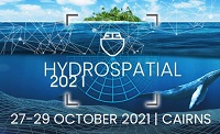
The Australasian Hydrographic Society’s HydroSpatial2021 Conference will focus on how hydrography will develop in the future, noting the development of ‘digital twinning’ and the emerging name variants for hydrography such as ‘hydrospatial’ or ‘hydrogeomatics’.
The conference theme, Hydrography of the Future, morphs two modern yet wide-ranging aspects of the hydrographic surveying profession, and should draw papers from relevant scientific, technological, operational and environmental communities. The aim is to provide delegates with valuable insights, creative ideas and inspiration on how to harness current and future technologies, systems and processes so that they can deal with present challenges and prepare for a more sustainable future.

As Australasia’s premier annual industry event, the Disaster & Emergency Management Conference attracts a passionate crowd of leaders and change-makers from government, private, and volunteer agencies working in disaster and emergency management.
Over two days, you will connect with emergency management professionals and subject matter experts offering insight, reflection, understanding and motivation across a wide range of topics and emergency management incidents.
Enjoy an impressive line-up of keynote speakers, presenters, and panel discussions, and leave with practical tools and techniques to ensure your team is best supported to better plan, prepare, and respond to emergencies, disasters, and rescue operations.
- Connect with emergency management personnel from state and local government, NGOs, and other recovery agencies.
- Explore and engage with exhibitor displays featuring the latest equipment, technologies, and agency services.
- Discover what is happening across multi-sectors via a program of renowned keynote speakers, sector representatives and lived-experience presenters.
- Gain practical tips, techniques, and strategies to incorporate into your organisation to improve the way you approach disaster and emergency planning, response & prevention.


