The Ocean Optics Conference attracts a diverse audience of active practitioners in the field, including oceanographers, marine ecologists, limnologists, optical engineers, marine resource managers and policy professionals from around the world.
Conference presentations will include the science of optics across all aquatic environments, research, and applications, including (but not limited to) biogeochemistry, environmental management and applications, instruments, techniques and observational systems, remote sensing, phytoplankton ecology, radiative transfer and optical theory, global change, and benthic processes.
Attendees will attend plenary presentations during the day and interact with colleagues during scientific poster session receptions held in the exhibit/poster hall in the early evening. In addition to invited and contributed oral and poster presentations, the conference will provide the opportunity for community-wide discussions.
NASA Earth Observatory image by Joshua Stevens, using Landsat data from the U.S. Geological Survey.

The 2022 SSSI Queensland Regional Conference will be held on Friday, 14 October at the Brisbane Convention & Exhibition Centre. It promises to once again be a fantastic opportunity to learn and connect with SSSI members and the broader surveying and spatial community.
The Queensland Asia-Pacific Spatial Excellence Awards dinner will also be held in conjunction with the conference, celebrating the outstanding work being undertaken across the region.
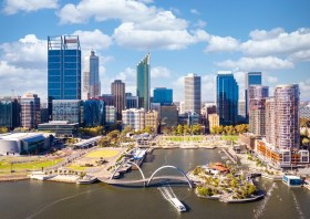
Image credit: ©stock.adobe.com/au/rudi1976

The 2022 SSSI Victorian Surveying & Spatial Summit and APSEA-V Dinner will take place on Thursday, 27 October 2022. It will be an opportunity for all Victorian surveying and spatial professionals to come together to learn, share and connect.
The event will feature an array of speakers, along with plenty of networking opportunities and the chance to see the latest products and services from local suppliers.
Image credit: ©stock.adobe.com/au/Wirestock

The 2022 SSSI NSW Regional Conference will be held on Thursday 10 November and Friday 11 November 2022 at the Novotel Sydney Central. The theme will be ‘Connections’.
This regular event is an opportunity to learn from and connect with other SSSI members and the broader geospatial community.
The first day will comprise the main conference, with speakers presenting on various topics, followed by the NSW & ACT Asia-Pacific Spatial Excellence Awards dinner in the evening.
The second day will be a NSW Spatial Digital Twin workshop, an interactive session that will get ‘under the bonnet,’ looking at data sharing, use cases and more.
The Call for Abstracts will close at midday on Monday, 26 September 2022. Abstract proposals can be submitted online at https://lnkd.in/ek4xS6Bu.
The organisers are seeking papers and presentations on a variety of topics, such as:
- technical innovation, spatial aps, cloud computing, survey innovation, RPAS
- data analytics, crowd sourcing, machine learning, artificial intelligence, automation, data partnerships
- surveying -—land, cadastral, hydrographic, aerial survey, engineering
- 3D, digital engineering, LiDAR, reality meshes, BIM
- mobility, emergency management, spatial digital twins, environment, community, smart cities, utilities, coastal management, climate change
- convergence of space and spatial
Registrations are now open online for the conference, dinner and workshop at https://lnkd.in/eVSxGWeB.
The event’s Principal and Major sponsors are the NSW Department of Customer Services–Spatial Services and TAFE NSW.

The Geospatial Council of Australia’s Western Australia Digital Twin Summit will be held on 15 November 2023.
The event will focus on Spatial Digital Twins, and attendees will hear the latest developments in this rapidly developing space from government, academia and private industry presenters.
The WA Asia-Pacific Spatial Excellence Awards dinner will also be held in conjunction with the conference, celebrating the outstanding work being undertaken across the region.
Image credit: ©stock.adobe.com/au/anekoho

The IGNSS Association’s biennial international GNSS conference will return to UNSW Sydney from 7 to 9 February, 2024, where it will celebrate the first half-century of GNSS and look ahead to the next 50 years.
IGNSS 2024 will bring together experts, policy makers and emerging leaders from across the globe to examine the latest advances, present cutting edge research and discuss policy, market development and infrastructure.
The conference will also showcase Australia and New Zealand’s Southern Positioning Augmentation Network (SouthPAN), along with developments by other countries across the Asia-Pacific.
Topics to be covered at the conference will include:
- Autonomy on land, air, sea and in space
- Aviation and avionics
- Cooperative Intelligent Transport Systems
- Machine guidance applications in agriculture, construction and mining
- Maritime applications
- Uncrewed aerial systems
- Space applications of PNT in Earth orbit and for lunar and Martian exploration
- Positioning infrastructure
- GNSS vulnerability, resilience and risk
- Interference detection and mitigation
- Policies and standards
- SBAS and other augmentations
- Datums and geodesy
- National and international GNSS developments
- Emerging application areas for GNSS
- Key industries and their reliance on GNSS
- The multi-GNSS era
- Cyber security in PNT applications and infrastructure
- Alternative PNT
- State of the art in PNT algorithms and software development
- GNSS aiding and sensor fusion
- Positioning in GNSS denied environments
- Development of GNSS receiver hardware and firmware
- Precise position using smartphones
The organisers are encouraging early career researchers and industry representatives to present their work. The abstract submission process will open soon — keep an eye on the IGNSS website for announcements.
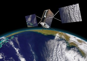
Image courtesy Lockheed-Martin

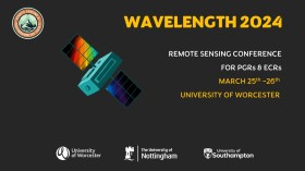
The Wavelength meeting was launched in 2013 for PhD students and early career researchers, addressing the demand for representation of new professionals as well as students from RSPSoc — the UK society for remote sensing and photogrammetry science.
Every year, Wavelength gathers participants from student and early career levels, as well as senior members and individuals within academia and business. The conference offers a setting to present student and EC work and meet new, like-minded contacts.
The 2024 conference will be run in a hybrid format, to accommodate those who can and those who cannot travel to Worcester.

The International Association of the IEEE-Geoscience and Remote Sensing Society (GRSS), the IEEE-Computational Intelligence Society (CIS) and the local organising committee invite geospatial and computing professionals to attend the International Conference on Machine Intelligence for GeoAnalytics and Remote Sensing (MIGARS) to be held in Wellington, Aotearoa New Zealand in April 2024.
MIGARS aims to explore the interface of machine intelligence approaches with geosciences, spatial analytics, and remote sensing. With the tremendous developments in remote sensing technology, data acquisitions and sensing platforms, digital data have grown leaps and bounds to stream and are too big by volume, variety, and veracity. The challenge is handling, processing, and automating geo-data from various sources, such as multi-platform remote sensors and IoT devices, informing decision-making and monitoring our planet.
The conference will focus on connecting researchers from various disciplines, including computation/artificial intelligence, engineering, remote sensing, hydrology, agriculture and geosciences, and look for the potential use of intelligent computational approaches for geo-data-based applications and for serving society at large.

The Institute of Navigation’s (ION) Pacific PNT Conference is a global event dedicated to the cooperative development of positioning, navigation and timing technology and applications.
The conference attracts policy and technical leaders from Japan, Singapore, China, South Korea, Australia, the United States and many other countries, who meet to discuss policy updates, receive program status updates and exchange technical information.
The conference will cover a wide range of topics:
- GNSS policy/status
- Polynesian navigation
- Aircraft navigation and surveillance
- Algorithms and methods
- Alternative navigation and signals of opportunity
- Aviation applications of GNSS
- Challenging navigation problems
- Emerging PNT consumer applications
- GNSS-R and GNSS-RO for environmental monitoring
- High-precision GNSS correction and monitoring networks
- Inertial navigation technology and applications
- Interference and spectrum
- Ionosphere monitoring with GNSS
- Natural hazards detection and other remote sensing applications
- Time and frequency distribution
- Space navigation technologies
Substantial discounts are available for early registrations.

The 2024 edition of the International Conference on Geographical Information Systems Theory, Applications and Management (GISTAM 2024) aims to create a meeting point of researchers and practitioners that address new challenges in geo-spatial data sensing, observation, representation, processing, visualization, sharing and managing, in all aspects concerning both ICT as well as management information systems and knowledge-based systems.
The conference welcomes original papers of either practical or theoretical nature, presenting research or applications, of specialised or interdisciplinary nature, addressing any aspect of geographic information systems and technologies, such as:
- Data acquisition and processing
- Remote sensing
- Interaction with spatial-temporal information
- Spatial data mining
- Managing spatial data
- Modelling, representation and visualisation
- GIS and climate change
- Domain applications


