Invitation to Graphene+2018: The 4th Industrial Revolution conference
Monday October 8, Hawthorn Arts Centre, Melbourne
Scientists, academia, advanced manufacturers and global start-up incubator leaders address: How Australia can spearhead the technology, and foster the start-up culture, that will drive the next generation of interconnectedness through the Internet of Things using graphene as the enabler of change.
Speakers include —
Government:
- Daniel Mulino MLC, Parliamentary Secretary for Treasury and Finance, Victoria
Startup incubation:
- Omer Gozen, VP, New Materials & Packaging, Plug and Play (USA)
Academia:
- Professor Linda Kristjanson AO, Vice Chancellor, Swinburne University
- Professor Bronwyn Fox, Director, Manufacturing Futures Research Institute, Swinburne University of Technology
- Professor David Officer, Centre of Excellence for Electromaterials Research
Business:
- Chris Gilbey OAM, CEO Imagine IM; Chair, Australian Graphene Industry Association
- Ray Gibbs, CEO, Haydale Limited
- Brendan Swifte, CEO, Geofabrics
- Elina Ollila, CEO, UX-Fit (USA)
- Dominic Rohrmus, Senior Engineer, Siemens AG (Germany)
- Professor Peter Middendorf, Director Arena2036 (Germany)
- Volkmar Doericht, R&D for Digitalization and Automation, Siemens (Germany)
Issues to be discussed include —
- Graphene: Solving big problems
- Designing Materials: Doing more with less
- From startup to billion dollar markets
- Invention, research and IP
- Making Australian manufacturing globally relevant
For the complete agenda, please visit: grapheneindustry.org.au/conference/schedule

About this Event
Everybody talks about UAV LiDAR – the engineer in planning, the forester involved in wood mass calculation, the construction companies taking part in large projects to model it before, during and after its implementation or the utility companies for their corridor mapping and infrastructures management.
Reasons enough for us to continue the Yellowscan Demo tour in Australia, under the motto « Measuring the world with UAV LiDAR ». The scope is to show this high tech tool in a real working environment and how easy it is to generate topographic data with UAV LiDAR.
During our tour you will learn about the latest solutions and use cases from YellowScan and its partners with lectures, workshops and open discussions.
We look forward to meeting you !
YellowScan will be demonstrating two systems:
– YellowScan Surveyor Ultra, the high density & long-range LiDAR solution for UAV. Thanks to its high density (600 000 shots per second), this turn-key fully autonomous system is ideally suited for high speed & long-range projects. Its light weight (1.7 kg battery included) makes it also easy to mount on any drone.
Ideal Use cases: Mining, Archeology, Powerlines.
Applanix APX-15 & Velodyne VLP-32 inside.
– YellowScan Vx-20, the high precision & long-range LiDAR solution for UAV. This system is ideally suited for long range survey needs advanced accuracy (2,5 cm) and precision (1 cm).
Ideal Use Cases: Civil engineering, Forestry
Applanix APX-20 & Riegl miniVUX inside.
LiDAR systems are renowned for under vegetation 3D modeling, and fast data processing.
Contact :
Contact us for any question at laure.fournier@yellowscan-lidar.com

The International Society for Photogrammetry and Remote Sensing (ISPRS) will hold its 2022 congress in Nice, France, in June 2022. The event will be hosted by the French Society for Photogrammetry and Remote Sensing.
A wide-ranging program has been put together, and it includes a host of leading speakers, such as Australia’s Professor Sisi Zlatanova from the University of South Wales. More than 1500 papers will be presented in the various scientific tracks and sessions over the week. In addition to these presentations, participants will also have the chance to interact and network face-to-face with the authors in poster sessions.
In order to help the registered participants to choose the sessions and the presentations to build their own program during the week, pre-recorded video presentations of the papers will made accessible before the beginning of the event through the digital platform of this event.
The Congress will have a strong technology track, with a large exhibition space that will gather the major players of the geospatial business. A geospatial prospective forum will also address hot topics of our community in order to draw recommendations.
The deadline for both full papers and abstracts is January 10, 2022.

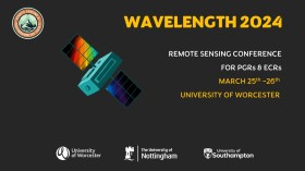
The Wavelength meeting was launched in 2013 for PhD students and early career researchers, addressing the demand for representation of new professionals as well as students from RSPSoc — the UK society for remote sensing and photogrammetry science.
Every year, Wavelength gathers participants from student and early career levels, as well as senior members and individuals within academia and business. The conference offers a setting to present student and EC work and meet new, like-minded contacts.
The 2024 conference will be run in a hybrid format, to accommodate those who can and those who cannot travel to Worcester.

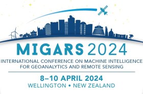
The International Association of the IEEE-Geoscience and Remote Sensing Society (GRSS), the IEEE-Computational Intelligence Society (CIS) and the local organising committee invite geospatial and computing professionals to attend the International Conference on Machine Intelligence for GeoAnalytics and Remote Sensing (MIGARS) to be held in Wellington, Aotearoa New Zealand in April 2024.
MIGARS aims to explore the interface of machine intelligence approaches with geosciences, spatial analytics, and remote sensing. With the tremendous developments in remote sensing technology, data acquisitions and sensing platforms, digital data have grown leaps and bounds to stream and are too big by volume, variety, and veracity. The challenge is handling, processing, and automating geo-data from various sources, such as multi-platform remote sensors and IoT devices, informing decision-making and monitoring our planet.
The conference will focus on connecting researchers from various disciplines, including computation/artificial intelligence, engineering, remote sensing, hydrology, agriculture and geosciences, and look for the potential use of intelligent computational approaches for geo-data-based applications and for serving society at large.

The 4th International Symposium on Applied Geoinformatics (ISAG2024), which will take place at the Wroclaw University of Science and Technology, Wroclaw, Poland, on 9 and 10 May 2024. ISAG2024 is jointly organised by the Department of Geomatics Engineering, Yildiz Technical University, Istanbul, Türkiye, Wroclaw University of Science and Technology, Wroclaw, Poland and Technical University of Crete, Chania, Crete, Greece.
The aim of the 4th ISAG is to bring scientists, engineers and industry researchers together to exchange and share their experiences and research results and discuss the practical challenges encountered and the solutions adopted in geoinformatics.
Topics to be covered include recent advances in AI, satellite imagery, advanced remote sensing, photogrammetry, image processing, global navigation satellite systems, height systems, terrestrial laser scanning, GIS, smart cities and land management.


