About this Event
Everybody talks about UAV LiDAR – the engineer in planning, the forester involved in wood mass calculation, the construction companies taking part in large projects to model it before, during and after its implementation or the utility companies for their corridor mapping and infrastructures management.
Reasons enough for us to continue the Yellowscan Demo tour in Australia, under the motto « Measuring the world with UAV LiDAR ». The scope is to show this high tech tool in a real working environment and how easy it is to generate topographic data with UAV LiDAR.
During our tour you will learn about the latest solutions and use cases from YellowScan and its partners with lectures, workshops and open discussions.
We look forward to meeting you !
YellowScan will be demonstrating two systems:
– YellowScan Surveyor Ultra, the high density & long-range LiDAR solution for UAV. Thanks to its high density (600 000 shots per second), this turn-key fully autonomous system is ideally suited for high speed & long-range projects. Its light weight (1.7 kg battery included) makes it also easy to mount on any drone.
Ideal Use cases: Mining, Archeology, Powerlines.
Applanix APX-15 & Velodyne VLP-32 inside.
– YellowScan Vx-20, the high precision & long-range LiDAR solution for UAV. This system is ideally suited for long range survey needs advanced accuracy (2,5 cm) and precision (1 cm).
Ideal Use Cases: Civil engineering, Forestry
Applanix APX-20 & Riegl miniVUX inside.
LiDAR systems are renowned for under vegetation 3D modeling, and fast data processing.
Contact :
Contact us for any question at laure.fournier@yellowscan-lidar.com

Presented by Bentley Institute, the Year in Infrastructure Conference is a global gathering of leading executives in the world of infrastructure design, construction, and operations focused on best practices and technologies for going digital.
The conference is globally recognized as the leading forum for addressing the current priorities and opportunities that impact the infrastructure industry. Attendees hear from industry thought leaders, engage in forums and discussions, and learn about technologies and best practices that will shape the future of infrastructure delivery and operations.
Keynotes
The Year in Infrastructure Conference mainstage is where industry leaders gain insight into how advancements in infrastructure, supported by Bentley technologies, are changing the world and accelerating possibilities. Mainstage presentations given by Greg Bentley and Keith Bentley share Bentley’s strategic vision and provide guidance for embracing going digital. Other presenters include Strategic Partner executives as well as respected global infrastructure leaders.
NEW for 2019! ACCELERATE
Join us at the brand-new ACCELERATE, and experience first-hand all the latest enhancements and key capabilities of CONNECT Edition. Meet Bentley’s product experts. Learn how to drive efficiency through multidiscipline workflows. Find out about infrastructure digital twins.

The Space & Geospatial Collaborative Workshop is being jointly hosted by the Andy Thomas Space Foundation and SSSI in Adelaide on 10 May 2023, in between the first 2023 Australian Space Forum and the Locate23 Conference.
This inter-disciplinary workshop will provide an opportunity for professionals from both space and spatial sectors to connect and discuss the increasing synergy and collaborative opportunities that have resulted from Australia’s renewed commitment to space technology development and the requirements and capabilities of the modern spatial information industry. The spatial professional has been an enduring end-user of space applications such as PNT (positioning, navigation and timing), EO (Earth observation) and telecommunications.

The IGNSS Association’s biennial international GNSS conference will return to UNSW Sydney from 7 to 9 February, 2024, where it will celebrate the first half-century of GNSS and look ahead to the next 50 years.
IGNSS 2024 will bring together experts, policy makers and emerging leaders from across the globe to examine the latest advances, present cutting edge research and discuss policy, market development and infrastructure.
The conference will also showcase Australia and New Zealand’s Southern Positioning Augmentation Network (SouthPAN), along with developments by other countries across the Asia-Pacific.
Topics to be covered at the conference will include:
- Autonomy on land, air, sea and in space
- Aviation and avionics
- Cooperative Intelligent Transport Systems
- Machine guidance applications in agriculture, construction and mining
- Maritime applications
- Uncrewed aerial systems
- Space applications of PNT in Earth orbit and for lunar and Martian exploration
- Positioning infrastructure
- GNSS vulnerability, resilience and risk
- Interference detection and mitigation
- Policies and standards
- SBAS and other augmentations
- Datums and geodesy
- National and international GNSS developments
- Emerging application areas for GNSS
- Key industries and their reliance on GNSS
- The multi-GNSS era
- Cyber security in PNT applications and infrastructure
- Alternative PNT
- State of the art in PNT algorithms and software development
- GNSS aiding and sensor fusion
- Positioning in GNSS denied environments
- Development of GNSS receiver hardware and firmware
- Precise position using smartphones
The organisers are encouraging early career researchers and industry representatives to present their work. The abstract submission process will open soon — keep an eye on the IGNSS website for announcements.
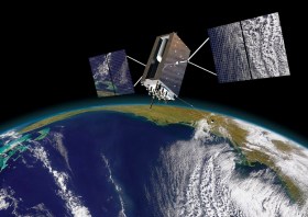
Image courtesy Lockheed-Martin


