AVALON 2019 – THE ESSENTIAL AVIATION, AEROSPACE AND DEFENCE SHOWCASE FOR AUSTRALIA AND THE ASIA PACIFIC REGION
The Asia Pacific region is undergoing major growth in defence and aviation, with budgets in many countries continuing to rise and an ever increasing level of sophistication in technologies, equipment, systems and operational methods.
One of the leading gateways to these important markets is AVALON 2019 – the Australian International Airshow and Aerospace & Defence Exposition staged at Avalon Airport, Geelong, Victoria.
AVALON 2019 will again present a unique opportunity to showcase products, technologies and services to an informed target audience and to demonstrate a marketing presence in this vibrant and vital region. High levels of economic growth and technological development have resulted in growing demand for aviation and aerospace services, products and technology, right across the spectrum from General Aviation to airlines, air forces and space.
AVALON 2019 will be a valuable opportunity for decision-makers to be informed and for exhibitors to connect with their customers.
The Australian International Airshow and Aerospace & Defence Exposition is the essential aviation, aerospace and defence event for the Asia Pacific.

The International Society for Photogrammetry and Remote Sensing (ISPRS) will hold its 2022 congress in Nice, France, in June 2022. The event will be hosted by the French Society for Photogrammetry and Remote Sensing.
A wide-ranging program has been put together, and it includes a host of leading speakers, such as Australia’s Professor Sisi Zlatanova from the University of South Wales. More than 1500 papers will be presented in the various scientific tracks and sessions over the week. In addition to these presentations, participants will also have the chance to interact and network face-to-face with the authors in poster sessions.
In order to help the registered participants to choose the sessions and the presentations to build their own program during the week, pre-recorded video presentations of the papers will made accessible before the beginning of the event through the digital platform of this event.
The Congress will have a strong technology track, with a large exhibition space that will gather the major players of the geospatial business. A geospatial prospective forum will also address hot topics of our community in order to draw recommendations.
The deadline for both full papers and abstracts is January 10, 2022.

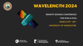
The Wavelength meeting was launched in 2013 for PhD students and early career researchers, addressing the demand for representation of new professionals as well as students from RSPSoc — the UK society for remote sensing and photogrammetry science.
Every year, Wavelength gathers participants from student and early career levels, as well as senior members and individuals within academia and business. The conference offers a setting to present student and EC work and meet new, like-minded contacts.
The 2024 conference will be run in a hybrid format, to accommodate those who can and those who cannot travel to Worcester.


