The Surveying and Spatial Sciences Institute invites you to engage with us at the Surveying & Spatial Sciences Institute NSW Conference 2018
The theme for this year’s conference:
“Earth – Air – Fire – Water”
The conference theme was chosen to reflect the diverse nature of spatial and surveying sciences which is inherently a multidisciplinary pursuit. Individuals within the spatial and surveying industry undertake many projects and tasks from the conference theme. From monitoring weather systems using small IoT devices to sending multi million dollar satellites into space, the surveying and spatial science fundamentals form the critical building blocks for success.
WHY NSW CONFERENCE?
Key opportunities at the conference:
- Meet a range of professionals and engage in presentations from industry leaders
- Explore the iconic coastline and fast growing city of Wollongong
- Network with people and make strong connections
- Celebrate NSWSEA with us at the Gala Dinner
Date: 14th-16th November 2018
Venue: Novotel Wollongong Northbeach
Registrations Now Open! To secure your place visit NSW Conference 2018 Registrations
CPD TOTAL: (Minimum points to be applied)
Spatial Stream including Keynote & Plenary sessions both days: 8.75 SP and 0.5 CAD
Surveying Stream including Keynote & Plenary sessions both days: 6 SP and 3.5 CAD
To view the Conference Programme click 2018 NSW SSSI Regional Conference Agenda (note Programme is subject to change by the Conference Organising Committee)
To nominate for the Awards click on the NSWSEA Awards Link
For a Nomination Kit click on 2018-APSEA-Nomination-Kit-FINAL.pdf
For accomodation details click here
Like to stay longer? Visit Wollongong
Interested in the Pre-Conference workshop on Fire Mapping? click here

WHERE TO NEXT? LOCATION, HOW WE DRIVE OUR DIGITAL FUTURE
The Locate Conference (Locate19) will explore how geospatial science is underpinning the rapid changes we are experiencing now in the fourth industrial revolution. From advanced data capture techniques, positioning, data analytics, artificial intelligence to strategy and policy, Locate 19 will explore how surveying and spatial science is a core enabling technology of the digital age . From health care, transport, consumer experience through to environment, energy, water, resources and smart cities, Locate19 will uncover the geospatial technologies driving our digital future, identify new insights and better outcomes for your organisation.
INVITATION TO ATTEND
On behalf of the Locate Conferences Australia it is our pleasure to invite you to join us at the Locate19 Conference, 8 – 10 April in Melbourne, Victoria.
Consistently named at the top of the world’s most liveable cities lists, Melbourne is Australia’s home of sport, art, live music, theatres, education and more. The MCEC Conference venue is on the banks of the Yarra River, in the heart of the city – the perfect location for the premier conference of the surveying and spatial industries in Australia and New Zealand.
With a theme of “Where to next? How geospatial science is driving our digital future” this conference will have an engaging approach that will bring together innovative global leaders who will share their ideas, knowledge, and experiences on a wide range of subjects. Every year Locate sets and shares the future direction of the industry, and brings speakers together across the government, private, non-profit and academic sectors.
You will have an opportunity to network with colleagues from all corners of the globe, have direct access to vendors and subject matter experts in the Interactive Zone, see the newest technology, and be introduced to the newest ideas in the spatial sector.
We look forward in seeing you in Melbourne.
GLENN COCKERTON & KATE WILLIAMS, CO-CONVENORS

About this Event
Everybody talks about UAV LiDAR – the engineer in planning, the forester involved in wood mass calculation, the construction companies taking part in large projects to model it before, during and after its implementation or the utility companies for their corridor mapping and infrastructures management.
Reasons enough for us to continue the Yellowscan Demo tour in Australia, under the motto « Measuring the world with UAV LiDAR ». The scope is to show this high tech tool in a real working environment and how easy it is to generate topographic data with UAV LiDAR.
During our tour you will learn about the latest solutions and use cases from YellowScan and its partners with lectures, workshops and open discussions.
We look forward to meeting you !
YellowScan will be demonstrating two systems:
– YellowScan Surveyor Ultra, the high density & long-range LiDAR solution for UAV. Thanks to its high density (600 000 shots per second), this turn-key fully autonomous system is ideally suited for high speed & long-range projects. Its light weight (1.7 kg battery included) makes it also easy to mount on any drone.
Ideal Use cases: Mining, Archeology, Powerlines.
Applanix APX-15 & Velodyne VLP-32 inside.
– YellowScan Vx-20, the high precision & long-range LiDAR solution for UAV. This system is ideally suited for long range survey needs advanced accuracy (2,5 cm) and precision (1 cm).
Ideal Use Cases: Civil engineering, Forestry
Applanix APX-20 & Riegl miniVUX inside.
LiDAR systems are renowned for under vegetation 3D modeling, and fast data processing.
Contact :
Contact us for any question at laure.fournier@yellowscan-lidar.com

Join us for the first session in our ‘Locate Connect’ online learning series! Hear from Scott Dewar, Director, Chris Hewett, Assistant Secretary GEOINT Capability and Development & Phil Shears, Director DEF799 Phase 2.
In this session from 1300 – 1400, the Australian Geospatial-Intelligence Organisation (AGO) will be launching the Defence Geospatial-Intelligence (GEOINT) Strategy, a document that addresses how the Defence GEOINT Community will transform to meet the future needs of the Australian Defence Force. The AGO Executive will also provide an update on their GEOINT projects and announce upcoming opportunities for industry and discuss how the COVID-19 pandemic has impacted the organisation.
Then from 1430 – 1545, AGO, along with Frontier SI will describe how The Analytics Lab Program (AGO Labs) fits into the bigger picture of AGO capability and summarise the outcomes of their 2019 activities. AGO Labs, coordinated through FrontierSI, is investigating a number of ways to better engage and work with industry. Specifically, the AGO is keen to attract a wider pool of companies and technologies to draw on for automated geospatial intelligence. The primary focus of this program is to address AGO capability challenges through a small number of short-term industry projects, with a focus on machine learning and analytics for producing automated imagery analysis, including automated object classification. AGO will announce a new 2020 program of challenges hoping to find innovative solutions through their partnership with FrontierSI.

Unable to hold its scheduled 2021 NSW Regional Conference earlier in 2022, SSSI is now inviting the spatial community to join it for a special online seminar featuring some of the speakers from the original program, along with the announcement of the NSW winners of the 2021 Asia-Pacific Spatial Excellence Awards.
This seminar will focus on the importance, efficiency and innovation spatial data can provide in crisis management situations and will feature presentations on:
- Finding your Friendship Island amongst a sea of COVID restrictions — presented by Stella Blake-Kelly, Founder/Director, Cartisan
- Geospatial Intelligence: Providing real-time insights supporting NSW State Emergency Service’s emergency management response — presented by Melissa Daley, Manager, Geospatial Intelligence Systems, NSW State Emergency Service
- COVID-19 Near Me: Trials and tribulations — presented by Kenneth Tsang, Director, jxeeno

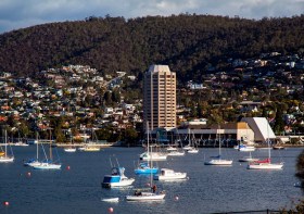
The 2022 Tasmania Surveying & Spatial Conference will be held on Friday, 2 September at Wrest Point in Hobart, and promises to be a fantastic opportunity to learn and network with SSSI members and the broader surveying and spatial community.
This year’s event will include a gala dinner, held in partnership with the University of Tasmania, to celebrate that institution’s 50 years in the field of surveying and spatial teaching.
In addition, the event will include the presentation of the 2022 Tasmanian Asia-Pacific Spatial Excellence Awards.
Image credit: ©stock.adobe.com/au/Norman

The 2022 SSSI Queensland Regional Conference will be held on Friday, 14 October at the Brisbane Convention & Exhibition Centre. It promises to once again be a fantastic opportunity to learn and connect with SSSI members and the broader surveying and spatial community.
The Queensland Asia-Pacific Spatial Excellence Awards dinner will also be held in conjunction with the conference, celebrating the outstanding work being undertaken across the region.
Image credit: ©stock.adobe.com/au/rudi1976

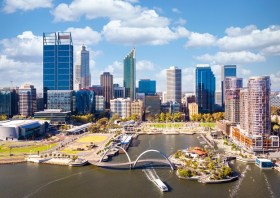
The Geospatial Council of Australia’s Western Australia Digital Twin Summit will be held on 15 November 2023.
The event will focus on Spatial Digital Twins, and attendees will hear the latest developments in this rapidly developing space from government, academia and private industry presenters.
The WA Asia-Pacific Spatial Excellence Awards dinner will also be held in conjunction with the conference, celebrating the outstanding work being undertaken across the region.
Image credit: ©stock.adobe.com/au/anekoho


