WHERE TO NEXT? LOCATION, HOW WE DRIVE OUR DIGITAL FUTURE
The Locate Conference (Locate19) will explore how geospatial science is underpinning the rapid changes we are experiencing now in the fourth industrial revolution. From advanced data capture techniques, positioning, data analytics, artificial intelligence to strategy and policy, Locate 19 will explore how surveying and spatial science is a core enabling technology of the digital age . From health care, transport, consumer experience through to environment, energy, water, resources and smart cities, Locate19 will uncover the geospatial technologies driving our digital future, identify new insights and better outcomes for your organisation.
INVITATION TO ATTEND
On behalf of the Locate Conferences Australia it is our pleasure to invite you to join us at the Locate19 Conference, 8 – 10 April in Melbourne, Victoria.
Consistently named at the top of the world’s most liveable cities lists, Melbourne is Australia’s home of sport, art, live music, theatres, education and more. The MCEC Conference venue is on the banks of the Yarra River, in the heart of the city – the perfect location for the premier conference of the surveying and spatial industries in Australia and New Zealand.
With a theme of “Where to next? How geospatial science is driving our digital future” this conference will have an engaging approach that will bring together innovative global leaders who will share their ideas, knowledge, and experiences on a wide range of subjects. Every year Locate sets and shares the future direction of the industry, and brings speakers together across the government, private, non-profit and academic sectors.
You will have an opportunity to network with colleagues from all corners of the globe, have direct access to vendors and subject matter experts in the Interactive Zone, see the newest technology, and be introduced to the newest ideas in the spatial sector.
We look forward in seeing you in Melbourne.
GLENN COCKERTON & KATE WILLIAMS, CO-CONVENORS

SSSI in conjunction with the Hunter Environmental Institute will present this webinar with three pre-eminent speakers:
Amy Steiger (Cardno)
Title: RPAS and thermal cameras for wildlife detection post-bushfire and coastal monitoring
Details: Amy has promoted the use of Remotely Piloted Aircraft Systems (RPAS) gaining experience with remote data capture to cover a range of coastal, environmental and land development applications.
RPAS thermal inspection capability was deployed this summer in wildlife detection post-bushfires.
Amy has also done volumetric surveys of beaches and flown isolated coastal cliff faces in NSW to capture high-resolution photography and derived photogrammetric models to identify geotechnical hazards and contribute to coastal monitoring.
Charity Mundava (WaterNSW)
Title: Remote Sensing in Water Management
Details: Charity will discuss the use of GIS and remote sensing to support water catchment management, feasibility and environmental studies for critical water infrastructure across the state and to support ongoing research into and management of river catchments. Charity will touch on the significance and spatial support for this in the recent NSW bushfires coordinating reservoir availability (in drought) and access for helicopter water drops and supporting bushfire fighting efforts.
Associate Professor In-Young Yeo (University of Newcastle)
Title: Remote sensing and GIS applications for water resources management
Details: Dr Yeo will explain how remote sensing can be used as a technique for assessing soil moisture using multi-source data fusion approaches, vegetation monitoring and water requirement with remote sensing and water balance approach.
She will explain the impacts of conservation management practices in agricultural catchments assessed using catchment model and remote sensing/GIS drawing on examples from Australian and American case studies
CPD Points
BOSSI CPD is 1 SP for this webinar.
Cost
As per details as follows
Contact
rom.nsw@sssi.org.au

The Geospatial Council of Australia’s Western Australia Digital Twin Summit will be held on 15 November 2023.
The event will focus on Spatial Digital Twins, and attendees will hear the latest developments in this rapidly developing space from government, academia and private industry presenters.
The WA Asia-Pacific Spatial Excellence Awards dinner will also be held in conjunction with the conference, celebrating the outstanding work being undertaken across the region.
Image credit: ©stock.adobe.com/au/anekoho

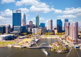
The not-to-be-missed Geospatial Council of Australia (GCA) WA Digital Twin Symposium will be held on 14 March in Perth, giving geospatial professionals a chance to learn about the latest developments in this important field.
- Members: $220 (incl. GST)
- Non-members: $330 (incl. GST)
- Student members: $95 (incl. GST)
Registrations will close on Wednesday 6 March.


