
Registrations for 1Spatial’s Annual Breakfast Seminar 2022 are open!
We would love to invite you to join our 3rd Annual Breakfast Seminar 2022 this October, which has limited number of seats available.
We are delighted to say that this event will be back in-person, around Australia!
Throughout the event, you will hear both customer and industry presentations that will focus on the challenges and opportunities for using and sharing geospatial data. There will be panel discussions and opportunities to network with your peers, our team, and other industry experts.
Building and Sustaining your Data Foundations
Strong data foundations are an essential requirement for the effective management of asset information and decision-making. Data needs to be accessible to organisations and their supply chain, to enable them to understand what information they have and need, what data can be upcycled sustainably, where data is located and who has access to it. To create good foundations that allow organisations to have confidence in their data, the quality, management and maintenance of that data is critical. Join us to find out more!
We look forward to welcoming you,
The 1Spatial Team

The 2022 SSSI Queensland Regional Conference will be held on Friday, 14 October at the Brisbane Convention & Exhibition Centre. It promises to once again be a fantastic opportunity to learn and connect with SSSI members and the broader surveying and spatial community.
The Queensland Asia-Pacific Spatial Excellence Awards dinner will also be held in conjunction with the conference, celebrating the outstanding work being undertaken across the region.
Image credit: ©stock.adobe.com/au/rudi1976

The 2022 SSSI Victorian Surveying & Spatial Summit and APSEA-V Dinner will take place on Thursday, 27 October 2022. It will be an opportunity for all Victorian surveying and spatial professionals to come together to learn, share and connect.
The event will feature an array of speakers, along with plenty of networking opportunities and the chance to see the latest products and services from local suppliers.
Image credit: ©stock.adobe.com/au/Wirestock

The 2022 SSSI NSW Regional Conference will be held on Thursday 10 November and Friday 11 November 2022 at the Novotel Sydney Central. The theme will be ‘Connections’.
This regular event is an opportunity to learn from and connect with other SSSI members and the broader geospatial community.
The first day will comprise the main conference, with speakers presenting on various topics, followed by the NSW & ACT Asia-Pacific Spatial Excellence Awards dinner in the evening.
The second day will be a NSW Spatial Digital Twin workshop, an interactive session that will get ‘under the bonnet,’ looking at data sharing, use cases and more.
The Call for Abstracts will close at midday on Monday, 26 September 2022. Abstract proposals can be submitted online at https://lnkd.in/ek4xS6Bu.
The organisers are seeking papers and presentations on a variety of topics, such as:
- technical innovation, spatial aps, cloud computing, survey innovation, RPAS
- data analytics, crowd sourcing, machine learning, artificial intelligence, automation, data partnerships
- surveying -—land, cadastral, hydrographic, aerial survey, engineering
- 3D, digital engineering, LiDAR, reality meshes, BIM
- mobility, emergency management, spatial digital twins, environment, community, smart cities, utilities, coastal management, climate change
- convergence of space and spatial
Registrations are now open online for the conference, dinner and workshop at https://lnkd.in/eVSxGWeB.
The event’s Principal and Major sponsors are the NSW Department of Customer Services–Spatial Services and TAFE NSW.
Join 1Spatial on our World Tour featuring FME!
BUILDING YOUR DATA FOUNDATIONS

The power is all yours; building stronger foundations, constructing the perfect data integration platform, and empowering the end-user all at a touch of a button. Register now!
1Spatial is hosting our very own World Tour, featuring FME. And it’s with great pleasure to be kick-starting this epic event in Australia, followed by Singapore, US and the UK!
During this Tour event, you’ll hear about the importance of foundation data and how customers trust 1Spatial’s wide range of products and solutions. You will learn how they are being used by clients all around the world and how they are saving time and money.
We are delighted to have Bob Chell, 1Spatial’s Chief Product Officer (CPO) from the UK joining the event to talk about the 1Spatial Products and how they are being used around the world.

Australian Tour dates – Register now!
- Perth – 08th May | DoubleTree by Hilton Perth Waterfront
- Adelaide – 9th May | Adelaide Convention Centre
- Hobart – 15th May | RACV Hobart Hotel
- Melbourne – 16th May Melbourne Marriott Hotel
- Canberra – 17th May | QT Canberra
- Brisbane – 18th May | Sofitel Brisbane Central
- Sydney – 19th May | Sheraton Grand Sydney Hyde Park
- Singapore – 30th May |Sheraton Towers Singapore


The International Cartographic Association (ICA) invites you to share your research, practice and experiences in cartography and GIScience at the 31st International Cartographic Conference (ICC 2023), to be held from 13 to 18 August 2023 in Cape Town, South Africa.
The conference theme will be ‘Smart Cartography for Sustainable Development’.
Important dates:
- 5 December 2022 – Submission of full papers closes
- 12 December 2022 – Submission of abstracts closes
- February 2023 – Conference registration opens
- 28 February 2023 – Notification of acceptance
- 8 May 2023 – Submission of revised abstracts and papers
- 15 May 2023 – Early Bird registration closes
- 15 May 2023 – Registration deadline for presenters of abstracts, papers and posters

The Local Government Spatial Reference Group (LGSRG) will be holding a webinar on Monday, 4 September, to introduce a series of hands-on workshops it will be holding across Victoria during September 2023.
The webinar will cover the topic of Best Practice Geospatial Intelligence for Climate Impact, and will address important topics on climate impact, community safety and how geospatial intelligence can contribute to better outcomes for local governments.
The LGSRG was formed in 2003 to address the need for a sector wide group representing the strategic interests of the Victorian Local Government sector with respect to spatial information. The LGSRG has been active throughout the COVID pandemic to keep the local government geospatial community connected and engaged via the annual Spatial Capability Workshop series which have grown year on year, and is now diversifying with a quarterly Spatial Hour webinar to share stories of success within the local government geospatial sector.
Image credit: ©stock.adobe.com/au/yutthana
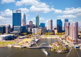
The Geospatial Council of Australia’s Western Australia Digital Twin Summit will be held on 15 November 2023.
The event will focus on Spatial Digital Twins, and attendees will hear the latest developments in this rapidly developing space from government, academia and private industry presenters.
The WA Asia-Pacific Spatial Excellence Awards dinner will also be held in conjunction with the conference, celebrating the outstanding work being undertaken across the region.
Image credit: ©stock.adobe.com/au/anekoho

The 2024 edition of the International Conference on Geographical Information Systems Theory, Applications and Management (GISTAM 2024) aims to create a meeting point of researchers and practitioners that address new challenges in geo-spatial data sensing, observation, representation, processing, visualization, sharing and managing, in all aspects concerning both ICT as well as management information systems and knowledge-based systems.
The conference welcomes original papers of either practical or theoretical nature, presenting research or applications, of specialised or interdisciplinary nature, addressing any aspect of geographic information systems and technologies, such as:
- Data acquisition and processing
- Remote sensing
- Interaction with spatial-temporal information
- Spatial data mining
- Managing spatial data
- Modelling, representation and visualisation
- GIS and climate change
- Domain applications

The 4th International Symposium on Applied Geoinformatics (ISAG2024), which will take place at the Wroclaw University of Science and Technology, Wroclaw, Poland, on 9 and 10 May 2024. ISAG2024 is jointly organised by the Department of Geomatics Engineering, Yildiz Technical University, Istanbul, Türkiye, Wroclaw University of Science and Technology, Wroclaw, Poland and Technical University of Crete, Chania, Crete, Greece.
The aim of the 4th ISAG is to bring scientists, engineers and industry researchers together to exchange and share their experiences and research results and discuss the practical challenges encountered and the solutions adopted in geoinformatics.
Topics to be covered include recent advances in AI, satellite imagery, advanced remote sensing, photogrammetry, image processing, global navigation satellite systems, height systems, terrestrial laser scanning, GIS, smart cities and land management.


