After too long an absence, we’re delighted to announce that GeoRabble Sydney will be back, on Thursday October 18th, from 6PM at the Occidental Hotel in York Street.
As usual, entry is free, and there will be pizza (courtesy of HERE Technologies)
Theme of this Rabble is “The Unusual Suspects” – celebrating the unusual, unsuspected, and surprising applications of geoinformation and -technology. Think using GPS for herding cattle, new uses of drones, photogrammetry in health, GIS on Mars, mapping in insurance and finance, to name just a few.

We are looking for speakers who have an ‘unusual suspect’ story to tell, in under 10 minutes. Do you have a story to tell about a left-field application, please let us know via email: sydney@georabble.org.
We’ll be announcing speakers soon. Click here for updates.

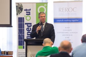
The latest in spatial data applications will be showcased at this year’s Mapped Out Conference to be held at the Rules Club in Wagga Wagga on Wednesday 2 & Thursday 3 March 2022.
Mapped Out will highlight the diversity of applications for spatial data, geographic information systems and their supporting technologies. Guest speakers with local and national experience will be showcasing the use of spatial data to enhance the operation and delivery of government services.
The Conference is a great opportunity for people working in regional NSW in both local government and the private sector to keep abreast of the latest technology and geographical information systems that can be utilised in their day to day work.

Survey and Spatial NZ’s 2022 conference will be held from 1 to 3 August at the Novotel Lakeside, Rotorua. The conference is the biggest continuing professional development event of the year for NZ surveying and spatial professionals. It invites sharing of knowledge amongst peers, bringing together networking opportunities for all delegates and is an essential event for professional development and connectivity within the sector.
The choice of Rotorua as the location is apt, given the conference theme of ‘Turning up the Heat’. The organisers aim to stimulate discussion regarding challenges in regional areas, which include climate change and developments outside of Auckland.

Hosted by the Riverina Eastern Regional Organisation of Councils and the Riverina Spatial Information Group, Mapped Out 2023 will bring together public- and private-sector professionals to learn about the latest geospatial developments.
Mapped Out will highlight the diversity of applications for spatial data, geographic information systems and their supporting technologies. Guest speakers with local and national experience will be showcasing the use of spatial data to enhance the operation and delivery of government services.
The Conference is a great opportunity for people working in regional NSW in both local government and the private sector to keep abreast of the latest technology and geographical information systems that can be utilised in their day-to-day work.

The 2024 edition of the International Conference on Geographical Information Systems Theory, Applications and Management (GISTAM 2024) aims to create a meeting point of researchers and practitioners that address new challenges in geo-spatial data sensing, observation, representation, processing, visualization, sharing and managing, in all aspects concerning both ICT as well as management information systems and knowledge-based systems.
The conference welcomes original papers of either practical or theoretical nature, presenting research or applications, of specialised or interdisciplinary nature, addressing any aspect of geographic information systems and technologies, such as:
- Data acquisition and processing
- Remote sensing
- Interaction with spatial-temporal information
- Spatial data mining
- Managing spatial data
- Modelling, representation and visualisation
- GIS and climate change
- Domain applications


