Learn how to ‘geo-enlighten your organisation’ at Directions LIVE 2016.
This year’s roadshow will highlight how you can extend the benefits of geospatial technology throughout your entire business – to streamline workflows and maximise your return on investment.
Discover how to further leverage the ArcGIS platform’s spatial analysis capabilities and see how this technology gives your organisation the competitive edge.
At Directions LIVE 2016, you will learn the benefits of working with 3D and 4D data, how to select the perfect app to tackle any challenge, and how ArcGIS Pro complements ArcMap functionality.
We will also be showcasing the innovative ways local organisations are improving operational efficiency with GIS technology.
Directions LIVE is free for Esri users – with light lunch provided.
Register today to join our team of ArcGIS experts and your local GIS user community, and learn how to unlock the full potential of the platform – the market’s only complete GIS solution.

Survey and Spatial NZ’s 2022 conference will be held from 1 to 3 August at the Novotel Lakeside, Rotorua. The conference is the biggest continuing professional development event of the year for NZ surveying and spatial professionals. It invites sharing of knowledge amongst peers, bringing together networking opportunities for all delegates and is an essential event for professional development and connectivity within the sector.
The choice of Rotorua as the location is apt, given the conference theme of ‘Turning up the Heat’. The organisers aim to stimulate discussion regarding challenges in regional areas, which include climate change and developments outside of Auckland.

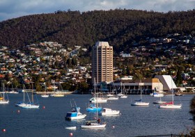
The 2022 Tasmania Surveying & Spatial Conference will be held on Friday, 2 September at Wrest Point in Hobart, and promises to be a fantastic opportunity to learn and network with SSSI members and the broader surveying and spatial community.
This year’s event will include a gala dinner, held in partnership with the University of Tasmania, to celebrate that institution’s 50 years in the field of surveying and spatial teaching.
In addition, the event will include the presentation of the 2022 Tasmanian Asia-Pacific Spatial Excellence Awards.
Image credit: ©stock.adobe.com/au/Norman

The 2023 Tasmanian Geospatial Conference & Awards Reception will be held at the Crowne Plaza in Hobart on 1 September 2023, where delegates will hear the latest news from across the local geospatial industry, including presentations on cadastral surveying, GIS, education and more.
Immediately following the conference will be the Geospatial Excellence Awards Reception, where all attendees will have the chance to enjoy drinks and canapes whilst networking and celebrating the local winners.
The full conference program is now available.
Image credit: ©stock.adobe.com/au/Norman


