Learn how to ‘geo-enlighten your organisation’ at Directions LIVE 2016.
This year’s roadshow will highlight how you can extend the benefits of geospatial technology throughout your entire business – to streamline workflows and maximise your return on investment.
Discover how to further leverage the ArcGIS platform’s spatial analysis capabilities and see how this technology gives your organisation the competitive edge.
At Directions LIVE 2016, you will learn the benefits of working with 3D and 4D data, how to select the perfect app to tackle any challenge, and how ArcGIS Pro complements ArcMap functionality.
We will also be showcasing the innovative ways local organisations are improving operational efficiency with GIS technology.
Directions LIVE is free for Esri users – with light lunch provided.
Register today to join our team of ArcGIS experts and your local GIS user community, and learn how to unlock the full potential of the platform – the market’s only complete GIS solution.

Registrations are now open for the Australian Institute of Mine Surveyors (AIMS) Kalgoorlie Regional Seminar, which will be held at the Kalgoorlie Bowling Club on Friday, 29 October.
The day will start at 2:30pm with an optional lawn bowls and beers social occasion, followed at 4:00pm by AIMS sessions and a sponsor interaction session. Drinks and nibbles will be supplied. Sponsors include AAM, Arvista, Caroni, Deswik, GeoCue Australia, HL Geospatial and Maptek.
There are various levels of registration fees depending upon member category. Full details can be found at the link above.

As Australasia’s premier annual industry event, the Disaster & Emergency Management Conference attracts a passionate crowd of leaders and change-makers from government, private, and volunteer agencies working in disaster and emergency management.
Over two days, you will connect with emergency management professionals and subject matter experts offering insight, reflection, understanding and motivation across a wide range of topics and emergency management incidents.
Enjoy an impressive line-up of keynote speakers, presenters, and panel discussions, and leave with practical tools and techniques to ensure your team is best supported to better plan, prepare, and respond to emergencies, disasters, and rescue operations.
- Connect with emergency management personnel from state and local government, NGOs, and other recovery agencies.
- Explore and engage with exhibitor displays featuring the latest equipment, technologies, and agency services.
- Discover what is happening across multi-sectors via a program of renowned keynote speakers, sector representatives and lived-experience presenters.
- Gain practical tips, techniques, and strategies to incorporate into your organisation to improve the way you approach disaster and emergency planning, response & prevention.

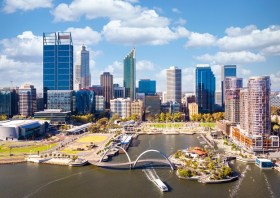
The WA geospatial community will come together on 16 February 2022 to learn, network, share experiences and catch up with colleagues old and new.
The WA Asia-Pacific Spatial Excellence Awards dinner will also be held in conjunction with the conference, celebrating the outstanding work being undertaken across the region during 2022.
Image credit: ©stock.adobe.com/au/anekoho


