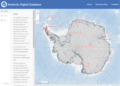
The British Antarctic Survey (BAS) has released a new map viewer that brings together all of the Antarctic Digital Database datasets, plus other useful information, and displays them together in an open-access interactive website.
The BAS’ Mapping and Geographic Information Centre (MAGIC) is responsible for keeping the maps and data up to date, with the aim of aiding safe travel and operations on the continent.
MAGIC compiles, manages and distributes data that makes up the Antarctic Digital Database, which provides a compilation of topographic data including coastline and contours.
The release of the open-access digital viewer coincides with the latest release of data updates, which record physical changes in Antarctica. New extents for some ice shelves have been drawn, where icebergs have calved away from the continent or where other ice shelves have grown by flowing away from the land.
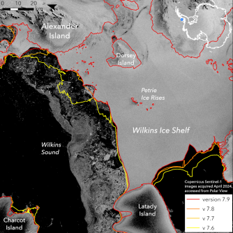
The coastline was also updated for the South Orkney Islands, the northernmost group of islands in Antarctica. Ice has been lost in these islands meaning that the glaciers are smaller than previously shown, and new islands have also been identified where glaciers have retreated to reveal islands underneath.
The location of certain offshore rocks and islands has also been improved due to improved imagery, enabling the BAS to locate small islands that previously might have been shown in the wrong location or not at all.