

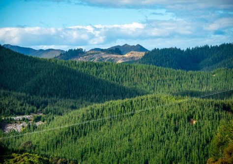
Australian and New Zealand researchers have used AI and 3D airborne laser scanning data to accurately map planted radiata pine forests for most of New Zealand’s North Island.
The technique has enabled them to distinguish between planted large estates, small woodlots and newly established stands as young as three years old, demonstrating a new way of using remote sensing with other technology to reveal forest growth and update growth information.
This approach is just as relevant for Australia, where radiata pine is also widely grown, says Dr Grant Pearse, Senior Lecturer in Remote Sensing and Geographic Information Systems (GIS) at Flinders University.
“In New Zealand, where radiata pine plantations dominate the forestry sector, the current national forest description lacks spatially explicit information and struggles to capture data on small-scale forests,” says Dr Pearse.
“We combined deep learning-based forest mapping using high-resolution aerial imagery with regional airborne laser scanning data to map all planted forest and estimate key attributes.”
The forest map derived from artificial intelligence can be viewed at forestinsights.nz.
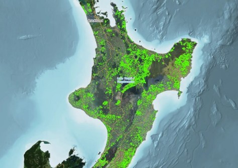
The spatially explicit forest description provides wall-to-wall information on forest extent, age and volume for all sizes of forest, facilitating stratification by key variables for wood supply forecasting, harvest planning and infrastructure investment decisions — applications equally valuable for other forestry industries.
The research, conducted with New Zealand timber industry researchers from Scion and Indufor Asia Pacific, was carried out on planted forests in the Gisborne region, which has publicly available aerial imagery and airborne laser scanning data.
This region is particularly significant as it was severely impacted by Cyclone Gabrielle in early 2023, which caused widespread landslides and forest debris flows.
For such vulnerable terrain, knowing exactly where forests are located in the landscape, their age and condition is key to managing the risks of harvesting operations on the region’s steep slopes.

“We propose satellite-based harvest detection and digital photogrammetry to continuously update the initial forest description,” the researchers write in their paper.
“This methodology enables near real-time monitoring of planted forests at all scales and is adaptable to other regions with similar data availability,” researchers say in a new article.
In addition to the economic importance of New Zealand’s 1.8 million hectares of radiata pine forestry for export timber and fibre, the planted forests are a key part of the country’s emission trading scheme and are expected to play a significant role in achieving the government’s target of net-zero emissions by 2050.


