


First partner in Australia to distribute ERDAS IMAGINE and ERDAS IMAGINE Photogrammetry products
Search results for "hexagon"

Hexagon to acquire Mintec
Mintec, software and service provider for the mining industry, will be acquired by Hexagon AB.
Hexagon 2013 Conference – HxGN LIVE
WHEN: 2013-06-03 to 2013-06-06WHERE: MGM Grand Hotel and Casino, Las Vegas, NevadaSTATE: InternationalCOUNTRY: INT Formerly known as Hexagon 2013, HxGN LIVE is the same great event you have come to expect, but with new and exciting ways to experience what’s unfolding in the world of design, measurement and visualisation technologies. The theme, “Great Stories […]

Hexagon 2012
Hexagon's second annual international conference attracted professionals from more than 70 countries to Las Vegas, Nevada, USA. Hexagon AB, provider of design, measurement and visualisation technologies, held its second annual international conference, Hexagon 2012, welcoming more than 3,000 attendees, including over 100 from Australia. The conference, held 4-7 June at MGM Grand […]
Hexagon acquires MicroSurvey Software
The Hexagon Group recently entered into an agreement to acquire all outstanding shares of MicroSurvey Software Inc., the Canadian-based developer of surveying and mapping software for the land surveying, construction, and forensic markets. "MicroSurvey has grown very rapidly in the last 2 years and the acquisition by Hexagon gives us the means to […]
Hexagon 2012
By bringing together the latest design, measurement and visualization technologies and user communities from Leica Geosystems, Intergraph, Z/I Imaging, ERDAS, Hexagon Metrology and NovAtel, Hexagon 2012 promises to provide an experience of unprecedented sc WHEN: 2012-06-04 to 2012-06-07WHERE: MGM Grand Hotel & Casino in Las Vegas, NevadaSTATE: InternationalCOUNTRY: INT Leica Geosystems announces that customers and […]

Locata announces indoor GPS, interface specs, Hexagon partnership
Australian-based company, Locata, has announced the industry's first GPS-style indoor positioning solution. The company's TimeTenna will enable new high-accuracy positioning, automation and robotics applications indoors where GPS signals don't reach. The company also announced that they have released the interface specifications (ICD) partners need to begin building receivers for Locata's ground-based positioning technology, and […]
Inaugural Hexagon 2011 international conference
Conference combines Intergraph, ERDAS, Leica Geosystems and Hexagon Metrology technologies. WHEN: 2011-06-06 to 2011-06-09WHERE: Orlando World Centre, Marriott Resort, Orlando, Florida, USASTATE: InternationalCOUNTRY: INT Hexagon AB will host its inaugural international conference, Hexagon 2011, 6-9 June at the Orlando World Center Marriott Resort in Orlando, Florida, USA. Hexagon 2011 will bring together the latest technologies […]
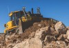
John Deere teams up with Leica Geosystems
The companies aim to boost the heavy construction sector through delivery of positioning and sensor tech.

US company awarded $1.8m LEO PNT R&D contract
Xona Space Systems will work on a secure PNT system with the US Space Force and Air Force Research Laboratory.


